Saint-Paul, Gironde
Saint-Paul | |
|---|---|
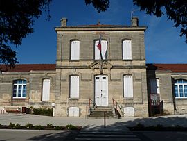 The town hall in Saint-Paul | |
 Coat of arms | |
show Location of Saint-Paul | |
 Saint-Paul | |
| Coordinates: 45°08′56″N 0°36′14″W / 45.1489°N 0.6039°WCoordinates: 45°08′56″N 0°36′14″W / 45.1489°N 0.6039°W | |
| Country | France |
| Region | Nouvelle-Aquitaine |
| Department | Gironde |
| Arrondissement | Blaye |
| Canton | L'Estuaire |
| Government | |
| • Mayor (2020–2026) | Jean-Pierre Duez |
| Area 1 | 10.87 km2 (4.20 sq mi) |
| Population (Jan. 2018)[1] | 956 |
| • Density | 88/km2 (230/sq mi) |
| Time zone | UTC+01:00 (CET) |
| • Summer (DST) | UTC+02:00 (CEST) |
| INSEE/Postal code | 33458 /33390 |
| Elevation | 17–46 m (56–151 ft) (avg. 31 m or 102 ft) |
| 1 French Land Register data, which excludes lakes, ponds, glaciers > 1 km2 (0.386 sq mi or 247 acres) and river estuaries. | |


Saint-Paul (French pronunciation: [sɛ̃ pɔl] (![]() listen)) is a commune in the Gironde department in Nouvelle-Aquitaine in southwestern France.
listen)) is a commune in the Gironde department in Nouvelle-Aquitaine in southwestern France.
Population[]
| Year | Pop. | ±% |
|---|---|---|
| 1962 | 693 | — |
| 1968 | 750 | +8.2% |
| 1975 | 704 | −6.1% |
| 1982 | 777 | +10.4% |
| 1990 | 831 | +6.9% |
| 1999 | 859 | +3.4% |
| 2008 | 916 | +6.6% |
See also[]
References[]
- ^ "Populations légales 2018". INSEE. 28 December 2020.
| Wikimedia Commons has media related to Saint-Paul (Gironde). |
This Gironde geographical article is a stub. You can help Wikipedia by . |
Categories:
- Communes of Gironde
- Gironde geography stubs