Léognan
Léognan | |
|---|---|
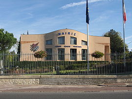 Town hall | |
 Coat of arms | |
show Location of Léognan | |
 Léognan | |
| Coordinates: 44°43′46″N 0°35′59″W / 44.7294°N 0.5997°WCoordinates: 44°43′46″N 0°35′59″W / 44.7294°N 0.5997°W | |
| Country | France |
| Region | Nouvelle-Aquitaine |
| Department | Gironde |
| Arrondissement | Bordeaux |
| Canton | La Brède |
| Intercommunality | Montesquieu |
| Government | |
| • Mayor (2008–2014) | Bernard Fath |
| Area 1 | 41.43 km2 (16.00 sq mi) |
| Population (Jan. 2018)[1] | 10,471 |
| • Density | 250/km2 (650/sq mi) |
| Time zone | UTC+01:00 (CET) |
| • Summer (DST) | UTC+02:00 (CEST) |
| INSEE/Postal code | 33238 /33850 |
| Elevation | 13–62 m (43–203 ft) (avg. 50 m or 160 ft) |
| 1 French Land Register data, which excludes lakes, ponds, glaciers > 1 km2 (0.386 sq mi or 247 acres) and river estuaries. | |


Léognan is a commune in the Gironde department, Nouvelle-Aquitaine, southwestern France.
Population[]
| Year | Pop. | ±% |
|---|---|---|
| 1962 | 2,674 | — |
| 1968 | 3,044 | +13.8% |
| 1975 | 5,141 | +68.9% |
| 1982 | 7,737 | +50.5% |
| 1990 | 8,008 | +3.5% |
| 1999 | 8,269 | +3.3% |
| 2008 | 9,021 | +9.1% |
Its inhabitants are called Léognanais.
Wine[]
It is located in the Graves area of the Bordeaux county, known for its red wine (Pessac-Léognan appellation):
- Château Haut-Bailly
- Domaine de Chevalier
- Château de Fieuzal
- Château Olivier
- Château Carbonnieux
- Château Malartic Lagravière
The processing plant for Cacolac has been located here since 2000.
See also[]
References[]
- ^ "Populations légales 2018". INSEE. 28 December 2020.
| Wikimedia Commons has media related to Léognan. |
| show Authority control |
|---|
This Gironde geographical article is a stub. You can help Wikipedia by . |
Categories:
- Communes of Gironde
- Gironde geography stubs