Daignac
Daignac | |
|---|---|
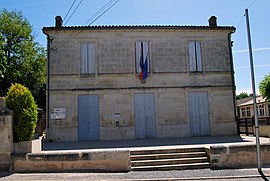 The town hall in Daignac | |
show Location of Daignac | |
 Daignac | |
| Coordinates: 44°48′01″N 0°14′54″W / 44.8003°N 0.2483°WCoordinates: 44°48′01″N 0°14′54″W / 44.8003°N 0.2483°W | |
| Country | France |
| Region | Nouvelle-Aquitaine |
| Department | Gironde |
| Arrondissement | Libourne |
| Canton | Les Coteaux de Dordogne |
| Intercommunality | |
| Government | |
| • Mayor (2014-2020) | Éric Lacoume |
| Area 1 | 5.73 km2 (2.21 sq mi) |
| Population (Jan. 2018)[1] | 470 |
| • Density | 82/km2 (210/sq mi) |
| Time zone | UTC+01:00 (CET) |
| • Summer (DST) | UTC+02:00 (CEST) |
| INSEE/Postal code | 33147 /33420 |
| Elevation | 16–86 m (52–282 ft) (avg. 77 m or 253 ft) |
| 1 French Land Register data, which excludes lakes, ponds, glaciers > 1 km2 (0.386 sq mi or 247 acres) and river estuaries. | |


Daignac is a commune in the Gironde department in southwestern France.
Population[]
| Year | Pop. | ±% |
|---|---|---|
| 2006 | 465 | — |
| 2007 | 473 | +1.7% |
| 2008 | 491 | +3.8% |
| 2009 | 484 | −1.4% |
| 2010 | 480 | −0.8% |
| 2011 | 476 | −0.8% |
| 2012 | 471 | −1.1% |
| 2013 | 478 | +1.5% |
| 2014 | 485 | +1.5% |
| 2015 | 481 | −0.8% |
| 2016 | 479 | −0.4% |
See also[]
References[]
- ^ "Populations légales 2018". INSEE. 28 December 2020.
| Wikimedia Commons has media related to Daignac. |
This Gironde geographical article is a stub. You can help Wikipedia by . |
Categories:
- Communes of Gironde
- Gironde geography stubs