Loubens, Gironde
Loubens | |
|---|---|
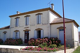 Town hall | |
show Location of Loubens | |
 Loubens | |
| Coordinates: 44°37′51″N 0°02′08″W / 44.6308°N 0.0356°WCoordinates: 44°37′51″N 0°02′08″W / 44.6308°N 0.0356°W | |
| Country | France |
| Region | Nouvelle-Aquitaine |
| Department | Gironde |
| Arrondissement | Langon |
| Canton | Le Réolais et Les Bastides |
| Intercommunality | Réolais en Sud Gironde |
| Government | |
| • Mayor (2008–2014) | Sylvette Saint-Marc |
| Area 1 | 5.89 km2 (2.27 sq mi) |
| Population (Jan. 2018)[1] | 306 |
| • Density | 52/km2 (130/sq mi) |
| Time zone | UTC+01:00 (CET) |
| • Summer (DST) | UTC+02:00 (CEST) |
| INSEE/Postal code | 33250 /33190 |
| Elevation | 13–94 m (43–308 ft) (avg. 44 m or 144 ft) |
| 1 French Land Register data, which excludes lakes, ponds, glaciers > 1 km2 (0.386 sq mi or 247 acres) and river estuaries. | |


Loubens (Occitan: Lobens) is a commune in the Gironde department in Nouvelle-Aquitaine in southwestern France.
Population[]
| Year | Pop. | ±% |
|---|---|---|
| 1962 | 231 | — |
| 1968 | 245 | +6.1% |
| 1975 | 209 | −14.7% |
| 1982 | 241 | +15.3% |
| 1990 | 315 | +30.7% |
| 1999 | 311 | −1.3% |
| 2008 | 305 | −1.9% |
See also[]
References[]
- ^ "Populations légales 2018". INSEE. 28 December 2020.
| Wikimedia Commons has media related to Loubens (Gironde). |
This Gironde geographical article is a stub. You can help Wikipedia by . |
Categories:
- Communes of Gironde
- Gironde geography stubs