Saint-Michel-de-Lapujade
Saint-Michel-de-Lapujade | |
|---|---|
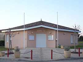 Town hall | |
show Location of Saint-Michel-de-Lapujade | |
 Saint-Michel-de-Lapujade | |
| Coordinates: 44°34′57″N 0°04′17″E / 44.5825°N 0.0714°ECoordinates: 44°34′57″N 0°04′17″E / 44.5825°N 0.0714°E | |
| Country | France |
| Region | Nouvelle-Aquitaine |
| Department | Gironde |
| Arrondissement | Langon |
| Canton | Le Réolais et Les Bastides |
| Intercommunality | Réolais en Sud Gironde |
| Government | |
| • Mayor (2008–2014) | Philippe Boissonneau |
| Area 1 | 7.47 km2 (2.88 sq mi) |
| Population (Jan. 2018)[1] | 228 |
| • Density | 31/km2 (79/sq mi) |
| Time zone | UTC+01:00 (CET) |
| • Summer (DST) | UTC+02:00 (CEST) |
| INSEE/Postal code | 33453 /33190 |
| Elevation | 24–122 m (79–400 ft) (avg. 85 m or 279 ft) |
| 1 French Land Register data, which excludes lakes, ponds, glaciers > 1 km2 (0.386 sq mi or 247 acres) and river estuaries. | |


Saint-Michel-de-Lapujade is a commune in the Gironde department in Nouvelle-Aquitaine in southwestern France.
Population[]
| Year | Pop. | ±% |
|---|---|---|
| 1962 | 212 | — |
| 1968 | 217 | +2.4% |
| 1975 | 209 | −3.7% |
| 1982 | 221 | +5.7% |
| 1990 | 222 | +0.5% |
| 1999 | 221 | −0.5% |
| 2008 | 198 | −10.4% |
See also[]
References[]
- ^ "Populations légales 2018". INSEE. 28 December 2020.
| Wikimedia Commons has media related to Saint-Michel-de-Lapujade. |
This Gironde geographical article is a stub. You can help Wikipedia by . |
Categories:
- Communes of Gironde
- Gironde geography stubs