Étauliers
Étauliers | |
|---|---|
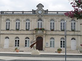 Town hall | |
show Location of Étauliers | |
 Étauliers | |
| Coordinates: 45°13′29″N 0°34′21″W / 45.2247°N 0.5725°WCoordinates: 45°13′29″N 0°34′21″W / 45.2247°N 0.5725°W | |
| Country | France |
| Region | Nouvelle-Aquitaine |
| Department | Gironde |
| Arrondissement | Blaye |
| Canton | L'Estuaire |
| Intercommunality | L'Estuaire |
| Government | |
| • Mayor (2014–2020) | Bernard Lavie Cambot |
| Area 1 | 12.98 km2 (5.01 sq mi) |
| Population (Jan. 2018)[1] | 1,484 |
| • Density | 110/km2 (300/sq mi) |
| Time zone | UTC+01:00 (CET) |
| • Summer (DST) | UTC+02:00 (CEST) |
| INSEE/Postal code | 33159 /33820 |
| Elevation | 1–23 m (3.3–75.5 ft) (avg. 7 m or 23 ft) |
| 1 French Land Register data, which excludes lakes, ponds, glaciers > 1 km2 (0.386 sq mi or 247 acres) and river estuaries. | |


Étauliers is a commune in the Gironde department in southwestern France.
Population[]
| Year | Pop. | ±% |
|---|---|---|
| 1962 | 779 | — |
| 1968 | 816 | +4.7% |
| 1975 | 760 | −6.9% |
| 1982 | 1,513 | +99.1% |
| 1990 | 1,294 | −14.5% |
| 1999 | 1,394 | +7.7% |
| 2008 | 1,687 | +21.0% |
| 2012 | 1,499 | −11.1% |
Twinning[]
SInce January 2012, the commune of Étauliers has been twinned with Plougrescant, a commune in Côtes-d'Armor, Brittany.[2]
See also[]
References[]
- ^ "Populations légales 2018". INSEE. 28 December 2020.
- ^ "Jumelage avec la Bretagne". Sud Ouest. 19 January 2012. Retrieved 24 April 2015.
| Wikimedia Commons has media related to Étauliers. |
This Gironde geographical article is a stub. You can help Wikipedia by . |
Categories:
- Communes of Gironde
- Gironde geography stubs