Générac, Gironde
Générac | |
|---|---|
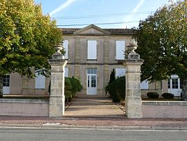 Town hall | |
show Location of Générac | |
 Générac | |
| Coordinates: 45°10′49″N 0°32′44″W / 45.1803°N 0.5456°WCoordinates: 45°10′49″N 0°32′44″W / 45.1803°N 0.5456°W | |
| Country | France |
| Region | Nouvelle-Aquitaine |
| Department | Gironde |
| Arrondissement | Blaye |
| Canton | Le Nord-Gironde |
| Government | |
| • Mayor (2014–2020) | Jean-Louis Imbert |
| Area 1 | 9.44 km2 (3.64 sq mi) |
| Population (Jan. 2018)[1] | 537 |
| • Density | 57/km2 (150/sq mi) |
| Time zone | UTC+01:00 (CET) |
| • Summer (DST) | UTC+02:00 (CEST) |
| INSEE/Postal code | 33184 /33920 |
| Elevation | 19–50 m (62–164 ft) (avg. 44 m or 144 ft) |
| 1 French Land Register data, which excludes lakes, ponds, glaciers > 1 km2 (0.386 sq mi or 247 acres) and river estuaries. | |


Générac is a commune in the Gironde department in southwestern France.
Population[]
| Year | Pop. | ±% |
|---|---|---|
| 1962 | 421 | — |
| 1968 | 486 | +15.4% |
| 1975 | 438 | −9.9% |
| 1982 | 460 | +5.0% |
| 1990 | 465 | +1.1% |
| 1999 | 493 | +6.0% |
| 2008 | 576 | +16.8% |
See also[]
References[]
- ^ "Populations légales 2018". INSEE. 28 December 2020.
| Wikimedia Commons has media related to Générac (Gironde). |
This Gironde geographical article is a stub. You can help Wikipedia by . |
Categories:
- Communes of Gironde
- Gironde geography stubs