Boitron, Orne
Boitron | |
|---|---|
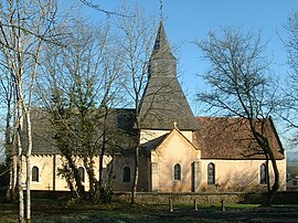 The church in Boitron | |
show Location of Boitron | |
 Boitron | |
| Coordinates: 48°33′40″N 0°15′50″E / 48.5611°N 0.2639°ECoordinates: 48°33′40″N 0°15′50″E / 48.5611°N 0.2639°E | |
| Country | France |
| Region | Normandy |
| Department | Orne |
| Arrondissement | Alençon |
| Canton | Sées |
| Government | |
| • Mayor (2020–2026) | Patrick Fleuriel[1] |
| Area 1 | 13.35 km2 (5.15 sq mi) |
| Population (Jan. 2018)[2] | 356 |
| • Density | 27/km2 (69/sq mi) |
| Time zone | UTC+01:00 (CET) |
| • Summer (DST) | UTC+02:00 (CEST) |
| INSEE/Postal code | 61051 /61500 |
| Elevation | 152–224 m (499–735 ft) (avg. 225 m or 738 ft) |
| 1 French Land Register data, which excludes lakes, ponds, glaciers > 1 km2 (0.386 sq mi or 247 acres) and river estuaries. | |


Boitron is a commune in the Orne department in northwestern France.
Population[]
|
|
See also[]
- Communes of the Orne department
- Parc naturel régional Normandie-Maine
References[]
- ^ "Répertoire national des élus: les maires". data.gouv.fr, Plateforme ouverte des données publiques françaises (in French). 2 December 2020.
- ^ "Populations légales 2018". INSEE. 28 December 2020.
| Wikimedia Commons has media related to Boitron (Orne). |
| show Communes of the Orne department |
|---|
This Orne geographical article is a stub. You can help Wikipedia by . |
Categories:
- Communes of Orne
- Orne geography stubs