Bréhain-la-Ville
Bréhain-la-Ville | |
|---|---|
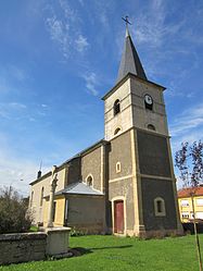 The church in Bréhain-la-Ville | |
 Coat of arms | |
show Location of Bréhain-la-Ville | |
 Bréhain-la-Ville | |
| Coordinates: 49°26′18″N 5°52′56″E / 49.4383°N 5.8822°ECoordinates: 49°26′18″N 5°52′56″E / 49.4383°N 5.8822°E | |
| Country | France |
| Region | Grand Est |
| Department | Meurthe-et-Moselle |
| Arrondissement | Briey |
| Canton | Villerupt |
| Government | |
| • Mayor (2020–2026) | Bernardino Pallotta[1] |
| Area 1 | 10.08 km2 (3.89 sq mi) |
| Population (Jan. 2018)[2] | 420 |
| • Density | 42/km2 (110/sq mi) |
| Time zone | UTC+01:00 (CET) |
| • Summer (DST) | UTC+02:00 (CEST) |
| INSEE/Postal code | 54096 /54190 |
| Elevation | 339–441 m (1,112–1,447 ft) (avg. 443 m or 1,453 ft) |
| 1 French Land Register data, which excludes lakes, ponds, glaciers > 1 km2 (0.386 sq mi or 247 acres) and river estuaries. | |


Bréhain-la-Ville (Luxembourgish: Leit-Bierchem) is a commune in the Meurthe-et-Moselle department in northeastern France.
Bréhain-la-Ville is including the Hamlet named Bréhain-la-Cour.
Population[]
| Year | Pop. | ±% |
|---|---|---|
| 1962 | 197 | — |
| 1968 | 225 | +14.2% |
| 1975 | 223 | −0.9% |
| 1982 | 175 | −21.5% |
| 1990 | 183 | +4.6% |
| 1999 | 227 | +24.0% |
| 2006 | 254 | +11.9% |
| 2009 | 285 | +12.2% |
See also[]
References[]
- ^ "Répertoire national des élus: les maires". data.gouv.fr, Plateforme ouverte des données publiques françaises (in French). 2 December 2020.
- ^ "Populations légales 2018". INSEE. 28 December 2020.
| Wikimedia Commons has media related to Bréhain-la-Ville. |
| show Authority control |
|---|
This Meurthe-et-Moselle geographical article is a stub. You can help Wikipedia by . |
Categories:
- Communes of Meurthe-et-Moselle
- Meurthe-et-Moselle geography stubs