Saint-Pancré
Saint-Pancré | |
|---|---|
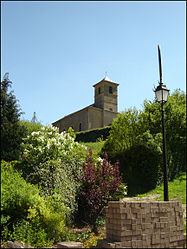 The church | |
 Coat of arms | |
show Location of Saint-Pancré | |
 Saint-Pancré | |
| Coordinates: 49°31′48″N 5°38′56″E / 49.53°N 5.6489°ECoordinates: 49°31′48″N 5°38′56″E / 49.53°N 5.6489°E | |
| Country | France |
| Region | Grand Est |
| Department | Meurthe-et-Moselle |
| Arrondissement | Briey |
| Canton | Mont-Saint-Martin |
| Intercommunality | Terre Lorraine du Longuyonnais |
| Government | |
| • Mayor (2020–2026) | René Saunier |
| Area 1 | 6.13 km2 (2.37 sq mi) |
| Population (Jan. 2018)[1] | 312 |
| • Density | 51/km2 (130/sq mi) |
| Time zone | UTC+01:00 (CET) |
| • Summer (DST) | UTC+02:00 (CEST) |
| INSEE/Postal code | 54485 /54730 |
| Elevation | 230–400 m (750–1,310 ft) (avg. 260 m or 850 ft) |
| 1 French Land Register data, which excludes lakes, ponds, glaciers > 1 km2 (0.386 sq mi or 247 acres) and river estuaries. | |


Saint-Pancré (French pronunciation: [sɛ̃ pɑ̃kʁe]) is a commune in the Meurthe-et-Moselle department in north-eastern France.
See also[]
References[]
- ^ "Populations légales 2018". INSEE. 28 December 2020.
| Wikimedia Commons has media related to Saint-Pancré. |
| show Authority control |
|---|
This Meurthe-et-Moselle geographical article is a stub. You can help Wikipedia by . |
Categories:
- Communes of Meurthe-et-Moselle
- Meurthe-et-Moselle geography stubs