Maxéville
Maxéville | |
|---|---|
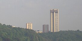 Tour panoramique, les Aulnes | |
 Coat of arms | |
show Location of Maxéville | |
 Maxéville | |
| Coordinates: 48°42′44″N 6°09′50″E / 48.7122°N 6.1639°ECoordinates: 48°42′44″N 6°09′50″E / 48.7122°N 6.1639°E | |
| Country | France |
| Region | Grand Est |
| Department | Meurthe-et-Moselle |
| Arrondissement | Nancy |
| Canton | Val de Lorraine Sud |
| Intercommunality | Métropole du Grand Nancy |
| Government | |
| • Mayor (2020–2026) | Christophe Choserot |
| Area 1 | 5.63 km2 (2.17 sq mi) |
| Population (Jan. 2018)[1] | 9,740 |
| • Density | 1,700/km2 (4,500/sq mi) |
| Time zone | UTC+01:00 (CET) |
| • Summer (DST) | UTC+02:00 (CEST) |
| INSEE/Postal code | 54357 /54320 |
| Elevation | 189–365 m (620–1,198 ft) (avg. 225 m or 738 ft) |
| Website | www.mairie-maxeville.fr |
| 1 French Land Register data, which excludes lakes, ponds, glaciers > 1 km2 (0.386 sq mi or 247 acres) and river estuaries. | |


Maxéville (French pronunciation: [maksevil]) is a commune in the Meurthe-et-Moselle department in north-eastern France.
See also[]
References[]
- ^ "Populations légales 2018". INSEE. 28 December 2020.
| Wikimedia Commons has media related to Maxéville. |
| show Authority control |
|---|
This Meurthe-et-Moselle geographical article is a stub. You can help Wikipedia by . |
Categories:
- Communes of Meurthe-et-Moselle
- Meurthe-et-Moselle geography stubs