Saint-Clément, Meurthe-et-Moselle
Saint-Clément | |
|---|---|
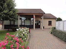 The town hall in Saint-Clément | |
 Coat of arms | |
show Location of Saint-Clément | |
 Saint-Clément | |
| Coordinates: 48°31′56″N 6°36′12″E / 48.5322°N 6.6033°ECoordinates: 48°31′56″N 6°36′12″E / 48.5322°N 6.6033°E | |
| Country | France |
| Region | Grand Est |
| Department | Meurthe-et-Moselle |
| Arrondissement | Lunéville |
| Canton | Baccarat |
| Government | |
| • Mayor (2008–2014) | Henri Meignan |
| Area 1 | 16.47 km2 (6.36 sq mi) |
| Population (Jan. 2018)[1] | 860 |
| • Density | 52/km2 (140/sq mi) |
| Time zone | UTC+01:00 (CET) |
| • Summer (DST) | UTC+02:00 (CEST) |
| INSEE/Postal code | 54472 /54950 |
| Elevation | 234–324 m (768–1,063 ft) (avg. 250 m or 820 ft) |
| 1 French Land Register data, which excludes lakes, ponds, glaciers > 1 km2 (0.386 sq mi or 247 acres) and river estuaries. | |


Saint-Clément is a commune in the Meurthe-et-Moselle department in north-eastern France.
See also[]
- It was there that a sister company of the Luneville Faience manufactory was founded by Jacques Chambrette in 1758. It still produces today both old & modern tableware and decorative ceramics.
- Communes of the Meurthe-et-Moselle department
References[]
- ^ "Populations légales 2018". INSEE. 28 December 2020.
| Wikimedia Commons has media related to Saint-Clément (Meurthe-et-Moselle). |
This Meurthe-et-Moselle geographical article is a stub. You can help Wikipedia by . |
Categories:
- Communes of Meurthe-et-Moselle
- Meurthe-et-Moselle geography stubs