Germonville
Germonville | |
|---|---|
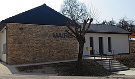 The town hall in Germonville | |
 Coat of arms | |
show Location of Germonville | |
 Germonville | |
| Coordinates: 48°24′28″N 6°12′47″E / 48.4078°N 6.2131°ECoordinates: 48°24′28″N 6°12′47″E / 48.4078°N 6.2131°E | |
| Country | France |
| Region | Grand Est |
| Department | Meurthe-et-Moselle |
| Arrondissement | Nancy |
| Canton | Meine au Saintois |
| Intercommunality | CC Pays du Saintois |
| Government | |
| • Mayor (2008–2014) | Dominique Simon |
| Area 1 | 5.21 km2 (2.01 sq mi) |
| Population (Jan. 2018)[1] | 120 |
| • Density | 23/km2 (60/sq mi) |
| Time zone | UTC+01:00 (CET) |
| • Summer (DST) | UTC+02:00 (CEST) |
| INSEE/Postal code | 54224 /54740 |
| Elevation | 283–382 m (928–1,253 ft) (avg. 309 m or 1,014 ft) |
| 1 French Land Register data, which excludes lakes, ponds, glaciers > 1 km2 (0.386 sq mi or 247 acres) and river estuaries. | |


Germonville is a commune in the Meurthe-et-Moselle department in north-eastern France.
See also[]
References[]
- ^ "Populations légales 2018". INSEE. 28 December 2020.
| Wikimedia Commons has media related to Germonville. |
This Meurthe-et-Moselle geographical article is a stub. You can help Wikipedia by . |
Categories:
- Communes of Meurthe-et-Moselle
- Meurthe-et-Moselle geography stubs