Tronville
Tronville | |
|---|---|
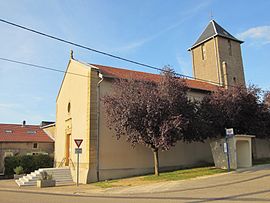 The church in Tronville | |
 Coat of arms | |
show Location of Tronville | |
 Tronville | |
| Coordinates: 49°05′09″N 5°55′14″E / 49.0858°N 5.9206°ECoordinates: 49°05′09″N 5°55′14″E / 49.0858°N 5.9206°E | |
| Country | France |
| Region | Grand Est |
| Department | Meurthe-et-Moselle |
| Arrondissement | Briey |
| Canton | Jarny |
| Intercommunality | Mad et Moselle |
| Government | |
| • Mayor (2008–2014) | Patrice Muzzin |
| Area 1 | 7 km2 (3 sq mi) |
| Population (Jan. 2018)[1] | 201 |
| • Density | 29/km2 (74/sq mi) |
| Time zone | UTC+01:00 (CET) |
| • Summer (DST) | UTC+02:00 (CEST) |
| INSEE/Postal code | 54535 /54800 |
| Elevation | 245–286 m (804–938 ft) (avg. 280 m or 920 ft) |
| 1 French Land Register data, which excludes lakes, ponds, glaciers > 1 km2 (0.386 sq mi or 247 acres) and river estuaries. | |


Tronville is a commune in the Meurthe-et-Moselle department in north-eastern France.
See also[]
References[]
- ^ "Populations légales 2018". INSEE. 28 December 2020.
| Wikimedia Commons has media related to Tronville. |
This Meurthe-et-Moselle geographical article is a stub. You can help Wikipedia by . |
Categories:
- Communes of Meurthe-et-Moselle
- Meurthe-et-Moselle geography stubs