Euvezin
Euvezin | |
|---|---|
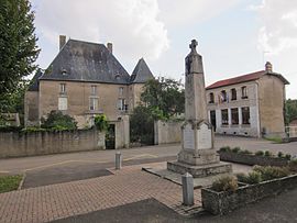 The main square in Euvezin | |
 Coat of arms | |
show Location of Euvezin | |
 Euvezin | |
| Coordinates: 48°55′29″N 5°50′20″E / 48.9247°N 5.8389°ECoordinates: 48°55′29″N 5°50′20″E / 48.9247°N 5.8389°E | |
| Country | France |
| Region | Grand Est |
| Department | Meurthe-et-Moselle |
| Arrondissement | Toul |
| Canton | Le Nord-Toulois |
| Intercommunality | Mad et Moselle |
| Government | |
| • Mayor (2020–2026) | Sabine Parmentelot |
| Area 1 | 11.28 km2 (4.36 sq mi) |
| Population (Jan. 2018)[1] | 112 |
| • Density | 9.9/km2 (26/sq mi) |
| Time zone | UTC+01:00 (CET) |
| • Summer (DST) | UTC+02:00 (CEST) |
| INSEE/Postal code | 54187 /54470 |
| Elevation | 208–328 m (682–1,076 ft) (avg. 213 m or 699 ft) |
| 1 French Land Register data, which excludes lakes, ponds, glaciers > 1 km2 (0.386 sq mi or 247 acres) and river estuaries. | |


Euvezin (French pronunciation: [øv(ə)zɛ̃]) is a commune in the Meurthe-et-Moselle department in north-eastern France.
Geography[]
The village lies on the left bank of the Rupt de Mad, which flows northeastward through the north-western part of the commune.
See also[]
References[]
- ^ "Populations légales 2018". INSEE. 28 December 2020.
| Wikimedia Commons has media related to Euvezin. |
This Meurthe-et-Moselle geographical article is a stub. You can help Wikipedia by . |
Categories:
- Communes of Meurthe-et-Moselle
- Meurthe-et-Moselle geography stubs