Méhoncourt
Méhoncourt | |
|---|---|
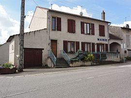 The town hall in Méhoncourt | |
 Coat of arms | |
show Location of Méhoncourt | |
 Méhoncourt | |
| Coordinates: 48°30′41″N 6°22′34″E / 48.5114°N 6.3761°ECoordinates: 48°30′41″N 6°22′34″E / ���48.5114°N 6.3761°E | |
| Country | France |
| Region | Grand Est |
| Department | Meurthe-et-Moselle |
| Arrondissement | Lunéville |
| Canton | Lunéville-2 |
| Intercommunality | CC Meurthe, Mortagne, Moselle |
| Government | |
| • Mayor (2020–2026) | Thierry Mercier[1] |
| Area 1 | 7.87 km2 (3.04 sq mi) |
| Population (Jan. 2018)[2] | 243 |
| • Density | 31/km2 (80/sq mi) |
| Time zone | UTC+01:00 (CET) |
| • Summer (DST) | UTC+02:00 (CEST) |
| INSEE/Postal code | 54359 /54360 |
| Elevation | 262–358 m (860–1,175 ft) (avg. 275 m or 902 ft) |
| 1 French Land Register data, which excludes lakes, ponds, glaciers > 1 km2 (0.386 sq mi or 247 acres) and river estuaries. | |


Méhoncourt is a commune in the Meurthe-et-Moselle department in north-eastern France.
See also[]
References[]
- ^ "Répertoire national des élus: les maires". data.gouv.fr, Plateforme ouverte des données publiques françaises (in French). 2 December 2020.
- ^ "Populations légales 2018". INSEE. 28 December 2020.
| Wikimedia Commons has media related to Méhoncourt. |
This Meurthe-et-Moselle geographical article is a stub. You can help Wikipedia by . |
Categories:
- Communes of Meurthe-et-Moselle
- Meurthe-et-Moselle geography stubs