Housséville
Housséville | |
|---|---|
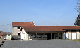 The town hall in Housséville | |
 Coat of arms | |
show Location of Housséville | |
 Housséville | |
| Coordinates: 48°24′25″N 6°07′07″E / 48.4069°N 6.1186°ECoordinates: 48°24′25″N 6°07′07″E / 48.4069°N 6.1186°E | |
| Country | France |
| Region | Grand Est |
| Department | Meurthe-et-Moselle |
| Arrondissement | Nancy |
| Canton | Meine au Saintois |
| Intercommunality | Pays du Saintois |
| Government | |
| • Mayor (2008–2014) | Francis Haye |
| Area 1 | 5.33 km2 (2.06 sq mi) |
| Population (Jan. 2018)[1] | 150 |
| • Density | 28/km2 (73/sq mi) |
| Time zone | UTC+01:00 (CET) |
| • Summer (DST) | UTC+02:00 (CEST) |
| INSEE/Postal code | 54268 /54930 |
| Elevation | 275–320 m (902–1,050 ft) (avg. 280 m or 920 ft) |
| 1 French Land Register data, which excludes lakes, ponds, glaciers > 1 km2 (0.386 sq mi or 247 acres) and river estuaries. | |


Housséville is a commune in the Meurthe-et-Moselle department in north-eastern France.
See also[]
References[]
- ^ "Populations légales 2018". INSEE. 28 December 2020.
| Wikimedia Commons has media related to Housséville. |
| show Authority control |
|---|
This Meurthe-et-Moselle geographical article is a stub. You can help Wikipedia by . |
Categories:
- Communes of Meurthe-et-Moselle
- Meurthe-et-Moselle geography stubs