Vannes-le-Châtel
Vannes-le-Châtel | |
|---|---|
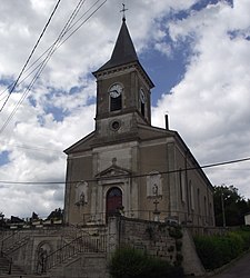 The church in Vannes-le-Châtel | |
 Coat of arms | |
show Location of Vannes-le-Châtel | |
 Vannes-le-Châtel | |
| Coordinates: 48°32′48″N 5°46′49″E / 48.5467°N 5.7803°ECoordinates: 48°32′48″N 5°46′49″E / 48.5467°N 5.7803°E | |
| Country | France |
| Region | Grand Est |
| Department | Meurthe-et-Moselle |
| Arrondissement | Toul |
| Canton | Meine au Saintois |
| Intercommunality | CC Pays de Colombey et Sud Toulois |
| Government | |
| • Mayor (2020–2026) | Nathalie Aufrere[1] |
| Area 1 | 17.3 km2 (6.7 sq mi) |
| Population (Jan. 2018)[2] | 553 |
| • Density | 32/km2 (83/sq mi) |
| Time zone | UTC+01:00 (CET) |
| • Summer (DST) | UTC+02:00 (CEST) |
| INSEE/Postal code | 54548 /54112 |
| Elevation | 267–432 m (876–1,417 ft) (avg. 290 m or 950 ft) |
| 1 French Land Register data, which excludes lakes, ponds, glaciers > 1 km2 (0.386 sq mi or 247 acres) and river estuaries. | |


Vannes-le-Châtel (French pronunciation: [van lə ʃatɛl]) is a commune in the Meurthe-et-Moselle department in north-eastern France.
See also[]
References[]
- ^ "Répertoire national des élus: les maires". data.gouv.fr, Plateforme ouverte des données publiques françaises (in French). 2 December 2020.
- ^ "Populations légales 2018". INSEE. 28 December 2020.
| Wikimedia Commons has media related to Vannes-le-Châtel. |
| show Authority control |
|---|
This Meurthe-et-Moselle geographical article is a stub. You can help Wikipedia by . |
Categories:
- Communes of Meurthe-et-Moselle
- Meurthe-et-Moselle geography stubs