Bratte
Bratte | |
|---|---|
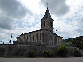 The church in Bratte | |
 Coat of arms | |
show Location of Bratte | |
 Bratte | |
| Coordinates: 48°48′52″N 6°12′59″E / 48.8144°N 6.2164°ECoordinates: 48°48′52″N 6°12′59″E / 48.8144°N 6.2164°E | |
| Country | France |
| Region | Grand Est |
| Department | Meurthe-et-Moselle |
| Arrondissement | Nancy |
| Canton | Entre Seille et Meurthe |
| Government | |
| • Mayor (2008–2014) | Michel Bedu |
| Area 1 | 3.28 km2 (1.27 sq mi) |
| Population (Jan. 2018)[1] | 45 |
| • Density | 14/km2 (36/sq mi) |
| Time zone | UTC+01:00 (CET) |
| • Summer (DST) | UTC+02:00 (CEST) |
| INSEE/Postal code | 54095 /54610 |
| Elevation | 260–405 m (853–1,329 ft) (avg. 330 m or 1,080 ft) |
| 1 French Land Register data, which excludes lakes, ponds, glaciers > 1 km2 (0.386 sq mi or 247 acres) and river estuaries. | |


Bratte is a commune in the Meurthe-et-Moselle department in northeastern France.
Population[]
| Year | Pop. | ±% |
|---|---|---|
| 1962 | 2 | — |
| 1968 | 17 | +750.0% |
| 1975 | 16 | −5.9% |
| 1982 | 30 | +87.5% |
| 1990 | 42 | +40.0% |
| 1999 | 42 | +0.0% |
| 2006 | 29 | −31.0% |
| 2009 | 38 | +31.0% |
See also[]
References[]
- ^ "Populations légales 2018". INSEE. 28 December 2020.
| Wikimedia Commons has media related to Bratte. |
This Meurthe-et-Moselle geographical article is a stub. You can help Wikipedia by . |
Categories:
- Communes of Meurthe-et-Moselle
- Meurthe-et-Moselle geography stubs