Clémery
Clémery | |
|---|---|
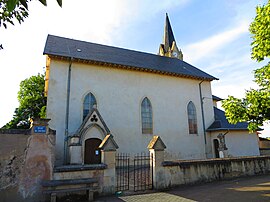 The church in Clémery | |
 Coat of arms | |
Location of Clémery  | |
 Clémery | |
| Coordinates: 48°53′41″N 6°11′11″E / 48.8947°N 6.1864°ECoordinates: 48°53′41″N 6°11′11″E / 48.8947°N 6.1864°E | |
| Country | France |
| Region | Grand Est |
| Department | Meurthe-et-Moselle |
| Arrondissement | Nancy |
| Canton | Entre Seille et Meurthe |
| Intercommunality | Seille et Grand Couronné |
| Government | |
| • Mayor (2020–2026) | Jean-Claude Grasser[1] |
| Area 1 | 9.45 km2 (3.65 sq mi) |
| Population (Jan. 2018)[2] | 495 |
| • Density | 52/km2 (140/sq mi) |
| Time zone | UTC+01:00 (CET) |
| • Summer (DST) | UTC+02:00 (CEST) |
| INSEE/Postal code | 54131 /54610 |
| Elevation | 179–226 m (587–741 ft) (avg. 180 m or 590 ft) |
| 1 French Land Register data, which excludes lakes, ponds, glaciers > 1 km2 (0.386 sq mi or 247 acres) and river estuaries. | |


Clémery is a commune in the Meurthe-et-Moselle department in north-eastern France.
See also[]
References[]
- ^ "Répertoire national des élus: les maires". data.gouv.fr, Plateforme ouverte des données publiques françaises (in French). 9 August 2021.
- ^ "Populations légales 2018". The National Institute of Statistics and Economic Studies. 28 December 2020.
| Wikimedia Commons has media related to Clémery. |
|
This Meurthe-et-Moselle geographical article is a stub. You can help Wikipedia by . |
Categories:
- Communes of Meurthe-et-Moselle
- Meurthe-et-Moselle geography stubs