Fourneaux-le-Val
Fourneaux-le-Val | |
|---|---|
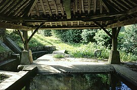 The public washhouse of Le Val Besnet | |
show Location of Fourneaux-le-Val | |
 Fourneaux-le-Val | |
| Coordinates: 48°51′20″N 0°15′55″W / 48.8556°N 0.2653°WCoordinates: 48°51′20″N 0°15′55″W / 48.8556°N 0.2653°W | |
| Country | France |
| Region | Normandy |
| Department | Calvados |
| Arrondissement | Caen |
| Canton | Falaise |
| Intercommunality | Pays de Falaise |
| Government | |
| • Mayor (2020–2026) | Denis Doutressoulles |
| Area 1 | 5.39 km2 (2.08 sq mi) |
| Population (Jan. 2018)[1] | 157 |
| • Density | 29/km2 (75/sq mi) |
| Time zone | UTC+01:00 (CET) |
| • Summer (DST) | UTC+02:00 (CEST) |
| INSEE/Postal code | 14284 /14700 |
| Elevation | 122–241 m (400–791 ft) (avg. 180 m or 590 ft) |
| 1 French Land Register data, which excludes lakes, ponds, glaciers > 1 km2 (0.386 sq mi or 247 acres) and river estuaries. | |


Fourneaux-le-Val (French pronunciation: [fuʁno lə val] (![]() listen)) is a commune in the Calvados department in the Normandy region in northwestern France.
listen)) is a commune in the Calvados department in the Normandy region in northwestern France.
Population[]
| Year | Pop. | ±% |
|---|---|---|
| 1962 | 154 | — |
| 1968 | 149 | −3.2% |
| 1975 | 138 | −7.4% |
| 1982 | 157 | +13.8% |
| 1990 | 183 | +16.6% |
| 1999 | 175 | −4.4% |
| 2008 | 178 | +1.7% |
See also[]
- Communes of the Calvados department
References[]
- ^ "Populations légales 2018". INSEE. 28 December 2020.
| Wikimedia Commons has media related to Fourneaux-le-Val. |
| show Communes of the Calvados department |
|---|
This Calvados geographical article is a stub. You can help Wikipedia by . |
Categories:
- Communes of Calvados (department)
- Calvados (department) geography stubs