May-sur-Orne
May-sur-Orne | |
|---|---|
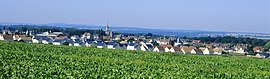 A general view of May-sur-Orne | |
 Coat of arms | |
show Location of May-sur-Orne | |
 May-sur-Orne | |
| Coordinates: 49°06′03″N 0°22′21″W / 49.1008°N 0.3725°WCoordinates: 49°06′03″N 0°22′21″W / 49.1008°N 0.3725°W | |
| Country | France |
| Region | Normandy |
| Department | Calvados |
| Arrondissement | Caen |
| Canton | Évrecy |
| Government | |
| • Mayor (2008–2014) | Martial Desflaches |
| Area 1 | 3.49 km2 (1.35 sq mi) |
| Population (Jan. 2018)[1] | 1,967 |
| • Density | 560/km2 (1,500/sq mi) |
| Time zone | UTC+01:00 (CET) |
| • Summer (DST) | UTC+02:00 (CEST) |
| INSEE/Postal code | 14408 /14320 |
| Elevation | 5–80 m (16–262 ft) (avg. 78 m or 256 ft) |
| 1 French Land Register data, which excludes lakes, ponds, glaciers > 1 km2 (0.386 sq mi or 247 acres) and river estuaries. | |


show This article may be expanded with text translated from the corresponding article in French. (December 2008) Click [show] for important translation instructions. |
May-sur-Orne is a commune in the Calvados department in the Normandy region in northwestern France.
Population[]
| Year | Pop. | ±% |
|---|---|---|
| 1962 | 1,049 | — |
| 1968 | 1,085 | +3.4% |
| 1975 | 1,240 | +14.3% |
| 1982 | 1,345 | +8.5% |
| 1990 | 1,635 | +21.6% |
| 1999 | 1,716 | +5.0% |
| 2008 | 1,876 | +9.3% |
See also[]
- Communes of the Calvados department
References[]
- ^ "Populations légales 2018". INSEE. 28 December 2020.
External links[]
| Wikimedia Commons has media related to May-sur-Orne. |
| show Communes of the Calvados department |
|---|
| show Authority control |
|---|
This Calvados geographical article is a stub. You can help Wikipedia by . |
Categories:
- Communes of Calvados (department)
- Calvados (department) geography stubs