Montchevrel
Montchevrel | |
|---|---|
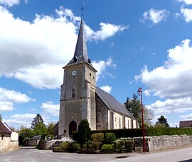 The church in Montchevrel | |
show Location of Montchevrel | |
 Montchevrel | |
| Coordinates: 48°34′26″N 0°20′24″E / 48.5739°N 0.34°ECoordinates: 48°34′26″N 0°20′24″E / 48.5739°N 0.34°E | |
| Country | France |
| Region | Normandy |
| Department | Orne |
| Arrondissement | Alençon |
| Canton | Écouves |
| Intercommunality | Vallée de la Haute Sarthe |
| Government | |
| • Mayor (2020–2026) | Hélène Provost-Olivier |
| Area 1 | 10.80 km2 (4.17 sq mi) |
| Population (Jan. 2018)[1] | 228 |
| • Density | 21/km2 (55/sq mi) |
| Time zone | UTC+01:00 (CET) |
| • Summer (DST) | UTC+02:00 (CEST) |
| INSEE/Postal code | 61284 /61170 |
| Elevation | 153–221 m (502–725 ft) (avg. 212 m or 696 ft) |
| 1 French Land Register data, which excludes lakes, ponds, glaciers > 1 km2 (0.386 sq mi or 247 acres) and river estuaries. | |


Montchevrel (French pronunciation: [mɔ̃ʃəvʁɛl] (![]() listen)) is a commune in the Orne department in north-western France.
listen)) is a commune in the Orne department in north-western France.
See also[]
- Communes of the Orne department
References[]
- ^ "Populations légales 2018". INSEE. 28 December 2020.
| Wikimedia Commons has media related to Montchevrel. |
| show Communes of the Orne department |
|---|
This Orne geographical article is a stub. You can help Wikipedia by . |
Categories:
- Communes of Orne
- Orne geography stubs