Saint-Fraimbault
Saint-Fraimbault | |
|---|---|
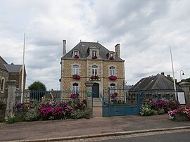 The town hall in Saint-Fraimbault | |
show Location of Saint-Fraimbault | |
 Saint-Fraimbault | |
| Coordinates: 48°29′14″N 0°41′54″W / 48.4872°N 0.6983°WCoordinates: 48°29′14″N 0°41′54″W / 48.4872°N 0.6983°W | |
| Country | France |
| Region | Normandy |
| Department | Orne |
| Arrondissement | Alençon |
| Canton | Bagnoles de l'Orne Normandie |
| Government | |
| • Mayor (2020–2026) | Éric Leroux |
| Area 1 | 28.59 km2 (11.04 sq mi) |
| Population (Jan. 2018)[1] | 541 |
| • Density | 19/km2 (49/sq mi) |
| Time zone | UTC+01:00 (CET) |
| • Summer (DST) | UTC+02:00 (CEST) |
| INSEE/Postal code | 61387 /61350 |
| Elevation | 107–196 m (351–643 ft) (avg. 150 m or 490 ft) |
| 1 French Land Register data, which excludes lakes, ponds, glaciers > 1 km2 (0.386 sq mi or 247 acres) and river estuaries. | |


Saint-Fraimbault (French pronunciation: [sɛ̃ fʁɛ̃bo] (![]() listen)) is a commune in the Orne department in north-western France.
listen)) is a commune in the Orne department in north-western France.
See also[]
- Communes of the Orne department
- Parc naturel régional Normandie-Maine
References[]
- ^ "Populations légales 2018". INSEE. 28 December 2020.
| Wikimedia Commons has media related to Saint-Fraimbault (Orne). |
| show Communes of the Orne department |
|---|
| show Authority control |
|---|
This Orne geographical article is a stub. You can help Wikipedia by . |
Categories:
- Communes of Orne
- Orne geography stubs