Saint-Omer, Calvados
show This article may be expanded with text translated from the corresponding article in French. (December 2008) Click [show] for important translation instructions. |
Saint-Omer | |
|---|---|
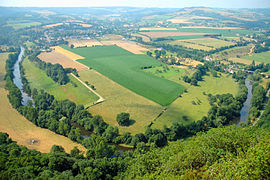 A hillside view of Saint-Omer | |
show Location of Saint-Omer | |
 Saint-Omer | |
| Coordinates: 48°55′36″N 0°27′07″W / 48.9267°N 0.4519°WCoordinates: 48°55′36″N 0°27′07″W / 48.9267°N 0.4519°W | |
| Country | France |
| Region | Normandy |
| Department | Calvados |
| Arrondissement | Caen |
| Canton | Thury-Harcourt |
| Government | |
| • Mayor (2020–2026) | Claudine Courval[1] |
| Area 1 | 8.07 km2 (3.12 sq mi) |
| Population (Jan. 2018)[2] | 187 |
| • Density | 23/km2 (60/sq mi) |
| Time zone | UTC+01:00 (CET) |
| • Summer (DST) | UTC+02:00 (CEST) |
| INSEE/Postal code | 14635 /14220 |
| Elevation | 90–306 m (295–1,004 ft) (avg. 306 m or 1,004 ft) |
| 1 French Land Register data, which excludes lakes, ponds, glaciers > 1 km2 (0.386 sq mi or 247 acres) and river estuaries. | |


Saint-Omer is a commune in the Calvados department in the Normandy region in northwestern France.
Population[]
| Year | Pop. | ±% |
|---|---|---|
| 1962 | 188 | — |
| 1968 | 182 | −3.2% |
| 1975 | 184 | +1.1% |
| 1982 | 162 | −12.0% |
| 1990 | 142 | −12.3% |
| 1999 | 157 | +10.6% |
| 2008 | 163 | +3.8% |
See also[]
- Communes of the Calvados department
References[]
- ^ "Répertoire national des élus: les maires". data.gouv.fr, Plateforme ouverte des données publiques françaises (in French). 2 December 2020.
- ^ "Populations légales 2018". INSEE. 28 December 2020.
| Wikimedia Commons has media related to Saint-Omer (Calvados). |
| show Communes of the Calvados department |
|---|
| show Authority control |
|---|
This Calvados geographical article is a stub. You can help Wikipedia by . |
Categories:
- Communes of Calvados (department)
- Calvados (department) geography stubs