Tinchebray-Bocage
Tinchebray-Bocage | |
|---|---|
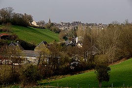 A general view of Tinchebray | |
show Location of Tinchebray-Bocage | |
 Tinchebray-Bocage | |
| Coordinates: 48°45′49″N 0°43′59″W / 48.7636°N 0.7331°WCoordinates: 48°45′49″N 0°43′59″W / 48.7636°N 0.7331°W | |
| Country | France |
| Region | Normandy |
| Department | Orne |
| Arrondissement | Argentan |
| Canton | Domfront en Poiraie |
| Intercommunality | |
| Government | |
| • Mayor (2020–2026) | Josette Porquet |
| Area 1 | 99.88 km2 (38.56 sq mi) |
| Population (Jan. 2018)[1] | 4,902 |
| • Density | 49/km2 (130/sq mi) |
| Time zone | UTC+01:00 (CET) |
| • Summer (DST) | UTC+02:00 (CEST) |
| INSEE/Postal code | 61486 /61800 |
| Elevation | 77–151 m (253–495 ft) |
| Website | www.tinchebray.fr |
| 1 French Land Register data, which excludes lakes, ponds, glaciers > 1 km2 (0.386 sq mi or 247 acres) and river estuaries. | |


Tinchebray-Bocage is a commune in the Orne department in the Normandy region in north-western France. The result of the merger, on 1 January 2015, of the communes of Beauchêne, Frênes, Larchamp, Saint-Cornier-des-Landes, Saint-Jean-des-Bois, Tinchebray and Yvrandes.[2]
See also[]
- Communes of the Orne department
References[]
- ^ "Populations légales 2018". INSEE. 28 December 2020.
- ^ (in French) Arrêté du 23 décembre 2014 portant création de la commune nouvelle de Tinchebray-Bocage
| Wikimedia Commons has media related to Tinchebray-Bocage. |
| show Communes of the Orne department |
|---|
This Orne geographical article is a stub. You can help Wikipedia by . |
Categories:
- Communes of Orne
- Orne geography stubs