Troarn
Troarn | |
|---|---|
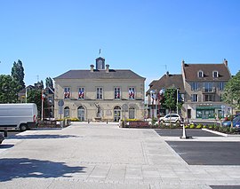 Paul Quellec Square | |
 Coat of arms | |
show Location of Troarn | |
 Troarn | |
| Coordinates: 49°10′56″N 0°11′00″W / 49.1822°N 0.1833°WCoordinates: 49°10′56″N 0°11′00″W / 49.1822°N 0.1833°W | |
| Country | France |
| Region | Normandy |
| Department | Calvados |
| Arrondissement | Caen |
| Canton | Troarn |
| Intercommunality | CU Caen Mer |
| Government | |
| • Mayor (2020–2026) | Christian Le Bas |
| Area 1 | 11.53 km2 (4.45 sq mi) |
| Population (Jan. 2018)[1] | 3,481 |
| • Density | 300/km2 (780/sq mi) |
| Time zone | UTC+01:00 (CET) |
| • Summer (DST) | UTC+02:00 (CEST) |
| INSEE/Postal code | 14712 /14670 |
| Elevation | 2–61 m (6.6–200.1 ft) (avg. 36 m or 118 ft) |
| 1 French Land Register data, which excludes lakes, ponds, glaciers > 1 km2 (0.386 sq mi or 247 acres) and river estuaries. | |


show This article may be expanded with text translated from the corresponding article in French. (December 2008) Click [show] for important translation instructions. |
Troarn (French pronunciation: [tʁɔ.aʁn]) is a commune in the Calvados in the Normandy region in northwestern France. On 1 January 2017, it was merged into the new commune Saline,[2] but this merger was undone on 31 December 2019.[3]
Population[]
| Year | Pop. | ±% |
|---|---|---|
| 1962 | 1,137 | — |
| 1968 | 1,375 | +20.9% |
| 1975 | 1,975 | +43.6% |
| 1982 | 3,011 | +52.5% |
| 1990 | 3,129 | +3.9% |
| 1999 | 3,176 | +1.5% |
| 2008 | 3,717 | +17.0% |
Sights[]
- The abbey founded by Roger de Montgomery in 1059
See also[]
- Communes of the Calvados department
References[]
- ^ "Populations légales 2018". INSEE. 28 December 2020.
- ^ Arrêté préfectoral 29 July 2016 (in French)
- ^ "Calvados. 1er janvier 2020, Saline n'existe plus, rebonjour Troarn et Sannerville". Ouest-France (in French). 2020-01-01.
| Wikimedia Commons has media related to Troarn. |
| show Communes of the Calvados department |
|---|
| show Authority control |
|---|
This Calvados geographical article is a stub. You can help Wikipedia by . |
Categories:
- Communes of Calvados (department)
- Calvados (department) geography stubs