Épreville-près-le-Neubourg
Épreville-près-le-Neubourg | |
|---|---|
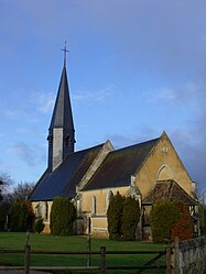 The church in Épreville-près-le-Neubourg | |
 Coat of arms | |
show Location of Épreville-près-le-Neubourg | |
 Épreville-près-le-Neubourg | |
| Coordinates: 49°08′12″N 0°52′53″E / 49.1367°N 0.8814°ECoordinates: 49°08′12″N 0°52′53″E / 49.1367°N 0.8814°E | |
| Country | France |
| Region | Normandy |
| Department | Eure |
| Arrondissement | Bernay |
| Canton | Le Neubourg |
| Government | |
| • Mayor (2020–2026) | Jean-Christophe Pisani[1] |
| Area 1 | 7.73 km2 (2.98 sq mi) |
| Population (Jan. 2018)[2] | 465 |
| • Density | 60/km2 (160/sq mi) |
| Time zone | UTC+01:00 (CET) |
| • Summer (DST) | UTC+02:00 (CEST) |
| INSEE/Postal code | 27224 /27110 |
| Elevation | 129–153 m (423–502 ft) (avg. 139 m or 456 ft) |
| 1 French Land Register data, which excludes lakes, ponds, glaciers > 1 km2 (0.386 sq mi or 247 acres) and river estuaries. | |


Épreville-près-le-Neubourg (French pronunciation: [epʁəvil pʁɛ lə nøbuʁ], Épreville near Le Neubourg) is a commune in the Eure department in the Normandy region in northern France.
Population[]
| Year | Pop. | ±% |
|---|---|---|
| 1962 | 252 | — |
| 1968 | 279 | +10.7% |
| 1975 | 335 | +20.1% |
| 1982 | 332 | −0.9% |
| 1990 | 349 | +5.1% |
| 1999 | 361 | +3.4% |
| 2008 | 453 | +25.5% |
See also[]
- Communes of the Eure department
References[]
- ^ "Répertoire national des élus: les maires". data.gouv.fr, Plateforme ouverte des données publiques françaises (in French). 2 December 2020.
- ^ "Populations légales 2018". INSEE. 28 December 2020.
| Wikimedia Commons has media related to Épreville-près-le-Neubourg. |
| show Communes of the Eure department |
|---|
This Eure geographical article is a stub. You can help Wikipedia by . |
Categories:
- Communes of Eure
- Eure geography stubs