Caugé
Caugé | |
|---|---|
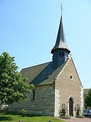 The church in Caugé | |
 Coat of arms | |
Location of Caugé  | |
 Caugé | |
| Coordinates: 49°01′33″N 1°02′08″E / 49.0258°N 1.0356°ECoordinates: 49°01′33″N 1°02′08″E / 49.0258°N 1.0356°E | |
| Country | France |
| Region | Normandy |
| Department | Eure |
| Arrondissement | Évreux |
| Canton | Conches-en-Ouche |
| Intercommunality | CA Évreux Portes de Normandie |
| Government | |
| • Mayor (2020–2026) | Jean-Marie Maillard |
| Area 1 | 11.61 km2 (4.48 sq mi) |
| Population (Jan. 2018)[1] | 862 |
| • Density | 74/km2 (190/sq mi) |
| Time zone | UTC+01:00 (CET) |
| • Summer (DST) | UTC+02:00 (CEST) |
| INSEE/Postal code | 27132 /27180 |
| Elevation | 105–146 m (344–479 ft) (avg. 142 m or 466 ft) |
| 1 French Land Register data, which excludes lakes, ponds, glaciers > 1 km2 (0.386 sq mi or 247 acres) and river estuaries. | |


Caugé (French pronunciation: [koʒe]) is a commune in the Eure department in northern France.
Population[]
| Year | Pop. | ±% |
|---|---|---|
| 1962 | 234 | — |
| 1968 | 243 | +3.8% |
| 1975 | 321 | +32.1% |
| 1982 | 609 | +89.7% |
| 1990 | 749 | +23.0% |
| 2008 | 823 | +9.9% |
See also[]
- Communes of the Eure department
References[]
- ^ "Populations légales 2018". The National Institute of Statistics and Economic Studies. 28 December 2020.
External links[]
| Wikimedia Commons has media related to Caugé. |
Communes of the Eure department | |
|---|---|
|
This Eure geographical article is a stub. You can help Wikipedia by . |
Categories:
- Communes of Eure
- Eure geography stubs