Saint-Éloi-de-Fourques
Saint-Éloi-de-Fourques | |
|---|---|
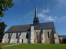 The church in Saint-Éloi-de-Fourques | |
show Location of Saint-Éloi-de-Fourques | |
 Saint-Éloi-de-Fourques | |
| Coordinates: 49°13′57″N 0°47′49″E / 49.2325°N 0.7969°ECoordinates: 49°13′57″N 0°47′49″E / 49.2325°N 0.7969°E | |
| Country | France |
| Region | Normandy |
| Department | Eure |
| Arrondissement | Bernay |
| Canton | Brionne |
| Government | |
| • Mayor (2020–2026) | Denis Szalkowski[1] |
| Area 1 | 7.23 km2 (2.79 sq mi) |
| Population (Jan. 2018)[2] | 530 |
| • Density | 73/km2 (190/sq mi) |
| Time zone | UTC+01:00 (CET) |
| • Summer (DST) | UTC+02:00 (CEST) |
| INSEE/Postal code | 27536 /27800 |
| Elevation | 115–159 m (377–522 ft) (avg. 152 m or 499 ft) |
| Website | www.saint-eloi-de-fourques.net |
| 1 French Land Register data, which excludes lakes, ponds, glaciers > 1 km2 (0.386 sq mi or 247 acres) and river estuaries. | |


Saint-Éloi-de-Fourques (French pronunciation: [sɛ̃.t‿elwa də fuʁk]) is a commune in the Eure department and Normandy region in northern France.
Population[]
| Year | Pop. | ±% |
|---|---|---|
| 1962 | 257 | — |
| 1968 | 284 | +10.5% |
| 1975 | 262 | −7.7% |
| 1982 | 311 | +18.7% |
| 1990 | 360 | +15.8% |
| 1999 | 419 | +16.4% |
| 2008 | 439 | +4.8% |
See also[]
- Communes of the Eure department
References[]
- ^ "Répertoire national des élus: les maires". data.gouv.fr, Plateforme ouverte des données publiques françaises (in French). 2 December 2020.
- ^ "Populations légales 2018". INSEE. 28 December 2020.
| Wikimedia Commons has media related to Saint-Éloi-de-Fourques. |
| show Communes of the Eure department |
|---|
This Eure geographical article is a stub. You can help Wikipedia by . |
Categories:
- Communes of Eure
- Eure geography stubs