Mesnils-sur-Iton
Mesnils-sur-Iton | |
|---|---|
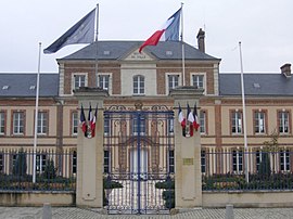 The town hall in Mesnils-sur-Iton | |
show Location of Mesnils-sur-Iton | |
 Mesnils-sur-Iton | |
| Coordinates: 48°52′16″N 1°04′30″E / 48.871°N 1.075°ECoordinates: 48°52′16″N 1°04′30″E / 48.871°N 1.075°E | |
| Country | France |
| Region | Normandy |
| Department | Eure |
| Arrondissement | Bernay |
| Canton | Breteuil and Verneuil d'Avre et d'Iton |
| Intercommunality | Normandie Sud Eure |
| Government | |
| • Mayor (2020–2026) | Colette Bonnard[1] |
| Area 1 | 125.03 km2 (48.27 sq mi) |
| Population (Jan. 2018)[2] | 6,126 |
| • Density | 49/km2 (130/sq mi) |
| Time zone | UTC+01:00 (CET) |
| • Summer (DST) | UTC+02:00 (CEST) |
| INSEE/Postal code | 27198 /27240, 27160 |
| 1 French Land Register data, which excludes lakes, ponds, glaciers > 1 km2 (0.386 sq mi or 247 acres) and river estuaries. | |


Mesnils-sur-Iton (French pronunciation: [mɛnil syʁ itɔ̃], literally Mesnils on Iton) is a commune in the department of Eure, northern France. The municipality was established on 1 January 2016 by merger of the former communes of Condé-sur-Iton, Damville (the seat), Gouville, Manthelon, Le Roncenay-Authenay and Le Sacq.[3] On 1 January 2019, the former communes Buis-sur-Damville, Grandvilliers and Roman were merged into Mesnils-sur-Iton.[4]
See also[]
- Communes of the Eure department
References[]
| Wikimedia Commons has media related to Mesnils-sur-Iton. |
- ^ "Répertoire national des élus: les maires". data.gouv.fr, Plateforme ouverte des données publiques françaises (in French). 2 December 2020. Retrieved 7 December 2020.
- ^ "Populations légales 2018". INSEE. 28 December 2020.
- ^ Arrêté préfectoral 23 November 2015 (in French)
- ^ Arrêté préfectoral 20 November 2018 (in French)
| show Communes of the Eure department |
|---|
This Eure geographical article is a stub. You can help Wikipedia by . |
Categories:
- Communes of Eure
- Populated places established in 2016
- 2016 establishments in France
- Eure geography stubs