Villiers-en-Désœuvre
From Wikipedia, the free encyclopedia
Commune in Normandy, France
Villiers-en-Désœuvre | |
|---|---|
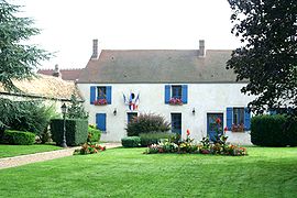 Town hall | |
 Villiers-en-Désœuvre  Villiers-en-Désœuvre | |
Coordinates:  48°56′54″N 1°29′19″E / 48.9483°N 1.4886°E / 48.9483; 1.4886Coordinates: 48°56′54″N 1°29′19″E / 48.9483°N 1.4886°E / 48.9483; 1.4886 48°56′54″N 1°29′19″E / 48.9483°N 1.4886°E / 48.9483; 1.4886Coordinates: 48°56′54″N 1°29′19″E / 48.9483°N 1.4886°E / 48.9483; 1.4886 | |
| Country | France |
| Region | Normandy |
| Department | Eure |
| Arrondissement | Les Andelys |
| Canton | Pacy-sur-Eure |
| Government | |
| • Mayor (2020–2026) | Christian Bidot |
| Area 1 | 14.65 km2 (5.66 sq mi) |
| Population (Jan. 2018)[1] | 937 |
| • Density | 64/km2 (170/sq mi) |
| Time zone | UTC+01:00 (CET) |
| • Summer (DST) | UTC+02:00 (CEST) |
| INSEE/Postal code | 27696 /27640 |
| Elevation | 82–167 m (269–548 ft) (avg. 139 m or 456 ft) |
| 1 French Land Register data, which excludes lakes, ponds, glaciers > 1 km2 (0.386 sq mi or 247 acres) and river estuaries. | |

Villiers-en-Désœuvre (French pronunciation: [vilje ɑ̃ dezœvʁ]) is a commune in the Eure department in Normandy in northern France.
Population[]
| Year | Pop. | ±% |
|---|---|---|
| 1962 | 437 | — |
| 1968 | 461 | +5.5% |
| 1975 | 439 | −4.8% |
| 1982 | 552 | +25.7% |
| 1990 | 687 | +24.5% |
| 1999 | 802 | +16.7% |
| 2008 | 918 | +14.5% |
See also[]
- Communes of the Eure department
References[]
- ^ "Populations légales 2018". INSEE. 28 December 2020.
| Wikimedia Commons has media related to Villiers-en-Désœuvre. |
show
Communes of the Eure department | |
|---|---|
|
This Eure geographical article is a stub. You can help Wikipedia by . |
- v
- t
Retrieved from ""
Categories:
- Communes of Eure
- Eure geography stubs
Hidden categories:
- Articles with short description
- Short description is different from Wikidata
- Infobox mapframe without OSM relation ID on Wikidata
- Coordinates on Wikidata
- Pages using infobox settlement with image map1 but not image map
- Commons category link from Wikidata
- Articles with BNF identifiers
- All stub articles
- Pages using the Kartographer extension