Saint-André-de-l'Eure
From Wikipedia, the free encyclopedia
Commune in Normandy, France
Saint-André-de-l'Eure | |
|---|---|
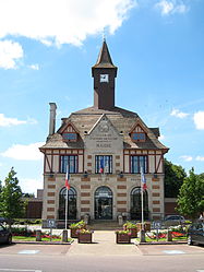 Town hall | |
 Coat of arms | |
 Saint-André-de-l'Eure  Saint-André-de-l'Eure | |
Coordinates:  48°54′27″N 1°16′38″E / 48.9075°N 1.2772°E / 48.9075; 1.2772Coordinates: 48°54′27″N 1°16′38″E / 48.9075°N 1.2772°E / 48.9075; 1.2772 48°54′27″N 1°16′38″E / 48.9075°N 1.2772°E / 48.9075; 1.2772Coordinates: 48°54′27″N 1°16′38″E / 48.9075°N 1.2772°E / 48.9075; 1.2772 | |
| Country | France |
| Region | Normandy |
| Department | Eure |
| Arrondissement | Évreux |
| Canton | Saint-André-de-l'Eure |
| Intercommunality | CA Évreux Portes de Normandie |
| Government | |
| • Mayor (2008–2014) | Serge Masson |
| Area 1 | 19.83 km2 (7.66 sq mi) |
| Population (Jan. 2018)[1] | 3,996 |
| • Density | 200/km2 (520/sq mi) |
| Time zone | UTC+01:00 (CET) |
| • Summer (DST) | UTC+02:00 (CEST) |
| INSEE/Postal code | 27507 /27220 |
| Dialling codes | 332 |
| Elevation | 120–149 m (394–489 ft) |
| 1 French Land Register data, which excludes lakes, ponds, glaciers > 1 km2 (0.386 sq mi or 247 acres) and river estuaries. | |

Saint-André-de-l'Eure is a commune in the Eure department in Normandy in northern France.
Population[]
| Year | Pop. | ±% |
|---|---|---|
| 1962 | 1,972 | — |
| 1968 | 2,013 | +2.1% |
| 1975 | 2,490 | +23.7% |
| 1982 | 2,703 | +8.6% |
| 1990 | 3,110 | +15.1% |
| 1999 | 3,258 | +4.8% |
| 2008 | 3,397 | +4.3% |
See also[]
- Communes of the Eure department
References[]
- ^ "Populations légales 2018". INSEE. 28 December 2020.
| Wikimedia Commons has media related to Saint-André-de-l'Eure. |
show
Communes of the Eure department | |
|---|---|
|
| show Authority control | |
|---|---|
| General |
|
| National libraries | |
This Eure geographical article is a stub. You can help Wikipedia by . |
- v
- t
Retrieved from ""
Categories:
- Communes of Eure
- Eure geography stubs
Hidden categories:
- Articles with short description
- Short description is different from Wikidata
- Infobox mapframe without OSM relation ID on Wikidata
- Coordinates on Wikidata
- Pages using infobox settlement with image map1 but not image map
- Commons category link from Wikidata
- Articles with VIAF identifiers
- Articles with BNF identifiers
- Articles with WorldCat-VIAF identifiers
- All stub articles
- Pages using the Kartographer extension