Moisville
From Wikipedia, the free encyclopedia
Commune in Normandy, France
Moisville | |
|---|---|
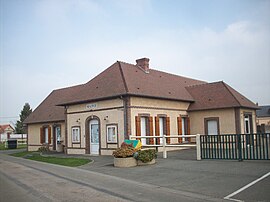 The town hall in Moisville | |
 Moisville  Moisville | |
Coordinates:  48°50′26″N 1°09′56″E / 48.8406°N 1.1656°E / 48.8406; 1.1656Coordinates: 48°50′26″N 1°09′56″E / 48.8406°N 1.1656°E / 48.8406; 1.1656 48°50′26″N 1°09′56″E / 48.8406°N 1.1656°E / 48.8406; 1.1656Coordinates: 48°50′26″N 1°09′56″E / 48.8406°N 1.1656°E / 48.8406; 1.1656 | |
| Country | France |
| Region | Normandy |
| Department | Eure |
| Arrondissement | Évreux |
| Canton | Verneuil d'Avre et d'Iton |
| Intercommunality | Évreux Portes de Normandie |
| Government | |
| • Mayor (2008–2014) | Martine Roussel |
| Area 1 | 6.99 km2 (2.70 sq mi) |
| Population (Jan. 2018)[1] | 236 |
| • Density | 34/km2 (87/sq mi) |
| Time zone | UTC+01:00 (CET) |
| • Summer (DST) | UTC+02:00 (CEST) |
| INSEE/Postal code | 27411 /27320 |
| Elevation | 146–159 m (479–522 ft) (avg. 158 m or 518 ft) |
| 1 French Land Register data, which excludes lakes, ponds, glaciers > 1 km2 (0.386 sq mi or 247 acres) and river estuaries. | |

Moisville is a commune in the Eure department in Normandy in northern France.
Population[]
| Year | Pop. | ±% |
|---|---|---|
| 1962 | 150 | — |
| 1968 | 158 | +5.3% |
| 1975 | 170 | +7.6% |
| 1982 | 148 | −12.9% |
| 1990 | 151 | +2.0% |
| 1999 | 167 | +10.6% |
| 2008 | 193 | +15.6% |
| 2016 | 666 | +245.1% |
See also[]
- Communes of the Eure department
References[]
- ^ "Populations légales 2018". INSEE. 28 December 2020.
| Wikimedia Commons has media related to Moisville. |
show
Communes of the Eure department | |
|---|---|
|
This Eure geographical article is a stub. You can help Wikipedia by . |
- v
- t
Retrieved from ""
Categories:
- Communes of Eure
- Eure geography stubs
Hidden categories:
- Articles with short description
- Short description is different from Wikidata
- Infobox mapframe without OSM relation ID on Wikidata
- Coordinates on Wikidata
- Pages using infobox settlement with image map1 but not image map
- Commons category link from Wikidata
- Articles with BNF identifiers
- All stub articles
- Pages using the Kartographer extension