Hécourt, Eure
Hécourt | |
|---|---|
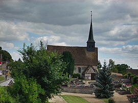 The church of Saint-Taurin in Hécourt | |
Location of Hécourt  | |
 Hécourt | |
| Coordinates: 48°58′45″N 1°25′20″E / 48.9792°N 1.4222°ECoordinates: 48°58′45″N 1°25′20″E / 48.9792°N 1.4222°E | |
| Country | France |
| Region | Normandy |
| Department | Eure |
| Arrondissement | Les Andelys |
| Canton | Pacy-sur-Eure |
| Intercommunality | Seine Normandie Agglomération |
| Government | |
| • Mayor (2020–2026) | Vincent Courtois |
| Area 1 | 7.73 km2 (2.98 sq mi) |
| Population (Jan. 2018)[1] | 322 |
| • Density | 42/km2 (110/sq mi) |
| Time zone | UTC+01:00 (CET) |
| • Summer (DST) | UTC+02:00 (CEST) |
| INSEE/Postal code | 27326 /27120 |
| Elevation | 42–135 m (138–443 ft) (avg. 56 m or 184 ft) |
| 1 French Land Register data, which excludes lakes, ponds, glaciers > 1 km2 (0.386 sq mi or 247 acres) and river estuaries. | |


Hécourt (French pronunciation: [ekuʁ]) is a commune in the Eure department and Normandy region of France.
Population[]
| Year | Pop. | ±% |
|---|---|---|
| 1962 | 157 | — |
| 1968 | 168 | +7.0% |
| 1975 | 183 | +8.9% |
| 1982 | 212 | +15.8% |
| 1990 | 274 | +29.2% |
| 1999 | 294 | +7.3% |
| 2008 | 342 | +16.3% |
See also[]
- Communes of the Eure department
References[]
- ^ "Populations légales 2018". The National Institute of Statistics and Economic Studies. 28 December 2020.
| Wikimedia Commons has media related to Hécourt (Eure). |
Communes of the Eure department | |
|---|---|
|
This Eure geographical article is a stub. You can help Wikipedia by . |
Categories:
- Communes of Eure
- Eure geography stubs