Saint-Léger-du-Gennetey
Saint-Léger-du-Gennetey | |
|---|---|
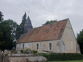 The church in Saint-Léger-du-Gennetey | |
show Location of Saint-Léger-du-Gennetey | |
 Saint-Léger-du-Gennetey | |
| Coordinates: 49°17′27″N 0°45′11″E / 49.2908°N 0.7531°ECoordinates: 49°17′27″N 0°45′11″E / 49.2908°N 0.7531°E | |
| Country | France |
| Region | Normandy |
| Department | Eure |
| Arrondissement | Bernay |
| Canton | Grand Bourgtheroulde |
| Government | |
| • Mayor (2020–2026) | Philippe Romain[1] |
| Area 1 | 3.27 km2 (1.26 sq mi) |
| Population (Jan. 2018)[2] | 179 |
| • Density | 55/km2 (140/sq mi) |
| Time zone | UTC+01:00 (CET) |
| • Summer (DST) | UTC+02:00 (CEST) |
| INSEE/Postal code | 27558 /27520 |
| Elevation | 76–145 m (249–476 ft) (avg. 91 m or 299 ft) |
| 1 French Land Register data, which excludes lakes, ponds, glaciers > 1 km2 (0.386 sq mi or 247 acres) and river estuaries. | |


Saint-Léger-du-Gennetey (French pronunciation: [sɛ̃ leʒe dy ʒɛntɛ]) is a commune in the Eure department in Normandy in northern France.
Population[]
| Year | Pop. | ±% |
|---|---|---|
| 1962 | 94 | — |
| 1968 | 96 | +2.1% |
| 1975 | 82 | −14.6% |
| 1982 | 88 | +7.3% |
| 1990 | 89 | +1.1% |
| 1999 | 106 | +19.1% |
| 2008 | 160 | +50.9% |
See also[]
- Communes of the Eure department
References[]
- ^ "Répertoire national des élus: les maires". data.gouv.fr, Plateforme ouverte des données publiques françaises (in French). 2 December 2020.
- ^ "Populations légales 2018". INSEE. 28 December 2020.
| Wikimedia Commons has media related to Saint-Léger-du-Gennetey. |
| show Communes of the Eure department |
|---|
This Eure geographical article is a stub. You can help Wikipedia by . |
Categories:
- Communes of Eure
- Eure geography stubs