Menneval
Menneval | |
|---|---|
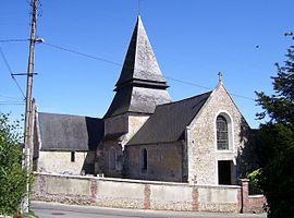 The church in Menneval | |
 Coat of arms | |
Location of Menneval  | |
 Menneval | |
| Coordinates: 49°05′53″N 0°37′29″E / 49.0981°N 0.6247°ECoordinates: 49°05′53″N 0°37′29″E / 49.0981°N 0.6247°E | |
| Country | France |
| Region | Normandy |
| Department | Eure |
| Arrondissement | Bernay |
| Canton | Bernay |
| Government | |
| • Mayor (2020–2026) | Françoise Canu |
| Area 1 | 6.63 km2 (2.56 sq mi) |
| Population (Jan. 2018)[1] | 1,460 |
| • Density | 220/km2 (570/sq mi) |
| Time zone | UTC+01:00 (CET) |
| • Summer (DST) | UTC+02:00 (CEST) |
| INSEE/Postal code | 27398 /27300 |
| Elevation | 90–164 m (295–538 ft) (avg. 150 m or 490 ft) |
| 1 French Land Register data, which excludes lakes, ponds, glaciers > 1 km2 (0.386 sq mi or 247 acres) and river estuaries. | |

Menneval (French pronunciation: [mɛnval]) is a commune in the Eure department in Normandy in northern France.
Population[]
| Year | Pop. | ±% |
|---|---|---|
| 1962 | 963 | — |
| 1968 | 1,073 | +11.4% |
| 1975 | 1,135 | +5.8% |
| 1982 | 1,325 | +16.7% |
| 1990 | 1,338 | +1.0% |
| 1999 | 1,322 | −1.2% |
| 2008 | 1,433 | +8.4% |
See also[]
- Communes of the Eure department
References[]
- ^ "Populations légales 2018". INSEE. 28 December 2020.
| Wikimedia Commons has media related to Menneval. |
Communes of the Eure department | |
|---|---|
|
This Eure geographical article is a stub. You can help Wikipedia by . |
Categories:
- Communes of Eure
- Eure geography stubs