Le Plessis-Hébert
From Wikipedia, the free encyclopedia
Commune in Normandy, France
Le Plessis-Hébert | |
|---|---|
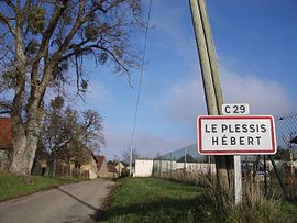 One of the roads into Le Plessis-Hébert | |
 Le Plessis-Hébert  Le Plessis-Hébert | |
Coordinates:  48°59′24″N 1°21′09″E / 48.99°N 1.3525°E / 48.99; 1.3525Coordinates: 48°59′24″N 1°21′09″E / 48.99°N 1.3525°E / 48.99; 1.3525 48°59′24″N 1°21′09″E / 48.99°N 1.3525°E / 48.99; 1.3525Coordinates: 48°59′24″N 1°21′09″E / 48.99°N 1.3525°E / 48.99; 1.3525 | |
| Country | France |
| Region | Normandy |
| Department | Eure |
| Arrondissement | Les Andelys |
| Canton | Pacy-sur-Eure |
| Government | |
| • Mayor (2008–2014) | Claude Bricout |
| Area 1 | 11.73 km2 (4.53 sq mi) |
| Population (Jan. 2018)[1] | 399 |
| • Density | 34/km2 (88/sq mi) |
| Time zone | UTC+01:00 (CET) |
| • Summer (DST) | UTC+02:00 (CEST) |
| INSEE/Postal code | 27465 /27120 |
| Elevation | 55–133 m (180–436 ft) (avg. 129 m or 423 ft) |
| 1 French Land Register data, which excludes lakes, ponds, glaciers > 1 km2 (0.386 sq mi or 247 acres) and river estuaries. | |

Le Plessis-Hébert is a commune in the Eure department in Normandy in northern France.
Population[]
| Year | Pop. | ±% |
|---|---|---|
| 1962 | 196 | — |
| 1968 | 201 | +2.6% |
| 1975 | 192 | −4.5% |
| 1982 | 258 | +34.4% |
| 1990 | 318 | +23.3% |
| 1999 | 345 | +8.5% |
| 2008 | 418 | +21.2% |
See also[]
- Communes of the Eure department
References[]
- ^ "Populations légales 2018". INSEE. 28 December 2020.
| Wikimedia Commons has media related to Le Plessis-Hébert. |
show
Communes of the Eure department | |
|---|---|
|
This Eure geographical article is a stub. You can help Wikipedia by . |
- v
- t
Retrieved from ""
Categories:
- Communes of Eure
- Eure geography stubs
Hidden categories:
- Articles with short description
- Short description is different from Wikidata
- Infobox mapframe without OSM relation ID on Wikidata
- Coordinates on Wikidata
- Pages using infobox settlement with image map1 but not image map
- Commons category link from Wikidata
- Articles with BNF identifiers
- All stub articles
- Pages using the Kartographer extension