Saint-Léger-de-Rôtes
From Wikipedia, the free encyclopedia
Commune in Normandy, France
Saint-Léger-de-Rôstes | |
|---|---|
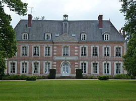 Chateau | |
 Saint-Léger-de-Rôstes  Saint-Léger-de-Rôstes | |
Coordinates:  49°06′38″N 0°38′56″E / 49.1106°N 0.6489°E / 49.1106; 0.6489Coordinates: 49°06′38″N 0°38′56″E / 49.1106°N 0.6489°E / 49.1106; 0.6489 49°06′38″N 0°38′56″E / 49.1106°N 0.6489°E / 49.1106; 0.6489Coordinates: 49°06′38″N 0°38′56″E / 49.1106°N 0.6489°E / 49.1106; 0.6489 | |
| Country | France |
| Region | Normandy |
| Department | Eure |
| Arrondissement | Bernay |
| Canton | Bernay |
| Government | |
| • Mayor (2020–2026) | Olivier Piquenot |
| Area 1 | 6.46 km2 (2.49 sq mi) |
| Population (Jan. 2018)[1] | 455 |
| • Density | 70/km2 (180/sq mi) |
| Time zone | UTC+01:00 (CET) |
| • Summer (DST) | UTC+02:00 (CEST) |
| INSEE/Postal code | 27557 /27300 |
| Elevation | 104–154 m (341–505 ft) (avg. 152 m or 499 ft) |
| 1 French Land Register data, which excludes lakes, ponds, glaciers > 1 km2 (0.386 sq mi or 247 acres) and river estuaries. | |

Saint-Léger-de-Rôtes (French pronunciation: [sɛ̃ leʒe də ʁot]) is a commune in the Eure department in Normandy in northern France.
Population[]
| Year | Pop. | ±% |
|---|---|---|
| 1962 | 317 | — |
| 1968 | 354 | +11.7% |
| 1975 | 405 | +14.4% |
| 1982 | 444 | +9.6% |
| 1990 | 465 | +4.7% |
| 1999 | 426 | −8.4% |
| 2008 | 420 | −1.4% |
See also[]
- Communes of the Eure department
References[]
- ^ "Populations légales 2018". INSEE. 28 December 2020.
| Wikimedia Commons has media related to Saint-Léger-de-Rôtes. |
show
Communes of the Eure department | |
|---|---|
|
This Eure geographical article is a stub. You can help Wikipedia by . |
- v
- t
Retrieved from ""
Categories:
- Communes of Eure
- Eure geography stubs
Hidden categories:
- Articles needing additional references from July 2013
- All articles needing additional references
- Articles with short description
- Short description is different from Wikidata
- Infobox mapframe without OSM relation ID on Wikidata
- Coordinates on Wikidata
- Pages using infobox settlement with image map1 but not image map
- Commons category link from Wikidata
- Articles with BNF identifiers
- All stub articles
- Pages using the Kartographer extension