La Boissière, Eure
From Wikipedia, the free encyclopedia
Commune in Normandy, France
La Boissière | |
|---|---|
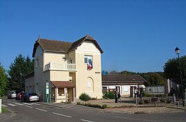 Town hall | |
 Coat of arms | |
 La Boissière  La Boissière | |
| Coordinates: 48°56′46″N 1°22′08″E / 48.9461°N 1.3689°E / 48.9461; 1.3689Coordinates: 48°56′46″N 1°22′08″E / 48.9461°N 1.3689°E / 48.9461; 1.3689 | |
| Country | France |
| Region | Normandy |
| Department | Eure |
| Arrondissement | Les Andelys |
| Canton | Pacy-sur-Eure |
| Government | |
| • Mayor (2008–2014) | François Marin-Ricci |
| Area 1 | 3.45 km2 (1.33 sq mi) |
| Population (Jan. 2018)[1] | 270 |
| • Density | 78/km2 (200/sq mi) |
| Time zone | UTC+01:00 (CET) |
| • Summer (DST) | UTC+02:00 (CEST) |
| INSEE/Postal code | 27078 /27220 |
| Elevation | 98–146 m (322–479 ft) (avg. 142 m or 466 ft) |
| 1 French Land Register data, which excludes lakes, ponds, glaciers > 1 km2 (0.386 sq mi or 247 acres) and river estuaries. | |

La Boissière is a commune in the Eure department in Normandy in northern France.
Population[]
| Year | Pop. | ±% |
|---|---|---|
| 1962 | 93 | — |
| 1968 | 101 | +8.6% |
| 1975 | 86 | −14.9% |
| 1982 | 121 | +40.7% |
| 1990 | 176 | +45.5% |
| 1999 | 225 | +27.8% |
| 2008 | 260 | +15.6% |
See also[]
- Communes of the Eure department
References[]
- ^ "Populations légales 2018". INSEE. 28 December 2020.
| Wikimedia Commons has media related to La Boissière (Eure). |
show
Communes of the Eure department | |
|---|---|
|
| Authority control |
|
|---|
This Eure geographical article is a stub. You can help Wikipedia by . |
- v
- t
Retrieved from ""
Categories:
- Communes of Eure
- Eure geography stubs
Hidden categories:
- Articles with short description
- Short description is different from Wikidata
- Infobox mapframe without OSM relation ID on Wikidata
- Coordinates on Wikidata
- Pages using infobox settlement with image map1 but not image map
- Commons category link is on Wikidata
- Articles with VIAF identifiers
- Articles with WorldCat-VIAF identifiers
- All stub articles
- Pages using the Kartographer extension