Autrepierre
Autrepierre | |
|---|---|
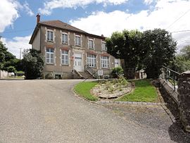 The town hall and school in Autrepierre | |
 Coat of arms | |
show Location of Autrepierre | |
 Autrepierre | |
| Coordinates: 48°36′45″N 6°48′07″E / 48.6125°N 6.8019°ECoordinates: 48°36′45″N 6°48′07″E / 48.6125°N 6.8019°E | |
| Country | France |
| Region | Grand Est |
| Department | Meurthe-et-Moselle |
| Arrondissement | Lunéville |
| Canton | Baccarat |
| Intercommunality | |
| Government | |
| • Mayor (2020–2026) | Yves Grelot |
| Area 1 | 7.75 km2 (2.99 sq mi) |
| Population (Jan. 2018)[1] | 83 |
| • Density | 11/km2 (28/sq mi) |
| Time zone | UTC+01:00 (CET) |
| • Summer (DST) | UTC+02:00 (CEST) |
| INSEE/Postal code | 54030 /54450 |
| Elevation | 254–346 m (833–1,135 ft) (avg. 290 m or 950 ft) |
| 1 French Land Register data, which excludes lakes, ponds, glaciers > 1 km2 (0.386 sq mi or 247 acres) and river estuaries. | |


Autrepierre (French pronunciation: [otʁəpjɛʁ]) is a commune in the Meurthe-et-Moselle department in northeastern France.
Population[]
| Year | Pop. | ±% |
|---|---|---|
| 1962 | 152 | — |
| 1968 | 157 | +3.3% |
| 1975 | 161 | +2.5% |
| 1982 | 133 | −17.4% |
| 1990 | 113 | −15.0% |
| 1999 | 108 | −4.4% |
| 2006 | 117 | +8.3% |
| 2009 | 120 | +2.6% |
| 2015 | 81 | −32.5% |
See also[]
References[]
- ^ "Populations légales 2018". INSEE. 28 December 2020.
| Wikimedia Commons has media related to Autrepierre. |
This Meurthe-et-Moselle geographical article is a stub. You can help Wikipedia by . |
Categories:
- Communes of Meurthe-et-Moselle
- Meurthe-et-Moselle geography stubs