Bassens, Gironde
Bassens | |
|---|---|
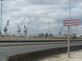 Docks | |
 Coat of arms | |
show Location of Bassens | |
 Bassens | |
| Coordinates: 44°50′24″N 0°31′18″W / 44.84°N 0.5217°WCoordinates: 44°50′24″N 0°31′18″W / 44.84°N 0.5217°W | |
| Country | France |
| Region | Nouvelle-Aquitaine |
| Department | Gironde |
| Arrondissement | Bordeaux |
| Canton | Lormont |
| Intercommunality | Bordeaux Métropole |
| Government | |
| • Mayor (2020–2026) | Alexandre Rubio |
| Area 1 | 10.27 km2 (3.97 sq mi) |
| Population (Jan. 2018)[1] | 7,404 |
| • Density | 720/km2 (1,900/sq mi) |
| Time zone | UTC+01:00 (CET) |
| • Summer (DST) | UTC+02:00 (CEST) |
| INSEE/Postal code | 33032 /33530 |
| Elevation | 2–56 m (6.6–183.7 ft) (avg. 45 m or 148 ft) |
| 1 French Land Register data, which excludes lakes, ponds, glaciers > 1 km2 (0.386 sq mi or 247 acres) and river estuaries. | |


Bassens (French pronunciation: [basɛ̃s]) is a commune in the Gironde department in southwestern France.
Population[]
| Year | Pop. | ±% |
|---|---|---|
| 1962 | 3,396 | — |
| 1968 | 4,841 | +42.6% |
| 1975 | 6,133 | +26.7% |
| 1982 | 6,595 | +7.5% |
| 1990 | 6,472 | −1.9% |
| 1999 | 6,978 | +7.8% |
| 2008 | 6,618 | −5.2% |
See also[]
References[]
- ^ "Populations légales 2018". INSEE. 28 December 2020.
| Wikimedia Commons has media related to Bassens (Gironde). |

| show Authority control |
|---|
This Gironde geographical article is a stub. You can help Wikipedia by . |
Categories:
- Communes of Gironde
- Gironde geography stubs