Beychac-et-Caillau
Beychac-et-Caillau | |
|---|---|
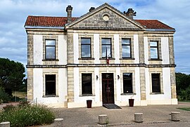 The town hall in Beychac-et-Caillau | |
 Coat of arms | |
show Location of Beychac-et-Caillau | |
 Beychac-et-Caillau | |
| Coordinates: 44°52′16″N 0°22′12″W / 44.8711°N 0.37°WCoordinates: 44°52′16″N 0°22′12″W / 44.8711°N 0.37°W | |
| Country | France |
| Region | Nouvelle-Aquitaine |
| Department | Gironde |
| Arrondissement | Bordeaux |
| Canton | La Presqu'île |
| Intercommunality | Secteur de Saint-Loubès |
| Government | |
| • Mayor (2020–2026) | Philippe Garrigue[1] |
| Area 1 | 15.62 km2 (6.03 sq mi) |
| Population (Jan. 2018)[2] | 2,268 |
| • Density | 150/km2 (380/sq mi) |
| Time zone | UTC+01:00 (CET) |
| • Summer (DST) | UTC+02:00 (CEST) |
| INSEE/Postal code | 33049 /33750 |
| Elevation | 10–84 m (33–276 ft) (avg. 46 m or 151 ft) |
| 1 French Land Register data, which excludes lakes, ponds, glaciers > 1 km2 (0.386 sq mi or 247 acres) and river estuaries. | |


Beychac-et-Caillau (French pronunciation: [beʃak e kajo]; Occitan: Baishac e Calhau) is a commune in the Gironde department in Nouvelle-Aquitaine in southwestern France. It is a wine-producing area.
Population[]
| Year | Pop. | ±% |
|---|---|---|
| 1962 | 711 | — |
| 1968 | 731 | +2.8% |
| 1975 | 976 | +33.5% |
| 1982 | 1,468 | +50.4% |
| 1990 | 1,611 | +9.7% |
| 1999 | 1,782 | +10.6% |
| 2008 | 1,986 | +11.4% |
See also[]
References[]
- ^ "Répertoire national des élus: les maires". data.gouv.fr, Plateforme ouverte des données publiques françaises (in French). 2 December 2020.
- ^ "Populations légales 2018". INSEE. 28 December 2020.
| Wikimedia Commons has media related to Beychac-et-Caillau. |
| show Authority control |
|---|
This Gironde geographical article is a stub. You can help Wikipedia by . |
Categories:
- Communes of Gironde
- Gironde geography stubs