Cabara
Cabara | |
|---|---|
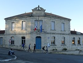 The town hall in Cabara | |
show Location of Cabara | |
 Cabara | |
| Coordinates: 44°49′41″N 0°09′31″W / 44.8281°N 0.1586°WCoordinates: 44°49′41″N 0°09′31″W / 44.8281°N 0.1586°W | |
| Country | France |
| Region | Nouvelle-Aquitaine |
| Department | Gironde |
| Arrondissement | Libourne |
| Canton | Les Coteaux de Dordogne |
| Intercommunality | |
| Government | |
| • Mayor (2020–2026) | Thierry Blanc[1] |
| Area 1 | 3.42 km2 (1.32 sq mi) |
| Population (Jan. 2018)[2] | 510 |
| • Density | 150/km2 (390/sq mi) |
| Time zone | UTC+01:00 (CET) |
| • Summer (DST) | UTC+02:00 (CEST) |
| INSEE/Postal code | 33078 /33420 |
| Elevation | 2–63 m (6.6–206.7 ft) (avg. 18 m or 59 ft) |
| 1 French Land Register data, which excludes lakes, ponds, glaciers > 1 km2 (0.386 sq mi or 247 acres) and river estuaries. | |


Cabara (French pronunciation: [kabaʁa]; Occitan: Cabarà) is a commune in the Gironde department in Nouvelle-Aquitaine in southwestern France.
Population[]
| Year | Pop. | ±% |
|---|---|---|
| 2006 | 347 | — |
| 2007 | 349 | +0.6% |
| 2008 | 350 | +0.3% |
| 2009 | 392 | +12.0% |
| 2010 | 396 | +1.0% |
| 2011 | 422 | +6.6% |
| 2012 | 447 | +5.9% |
| 2013 | 473 | +5.8% |
| 2014 | 500 | +5.7% |
| 2015 | 518 | +3.6% |
| 2016 | 515 | −0.6% |
See also[]
References[]
- ^ "Répertoire national des élus: les maires". data.gouv.fr, Plateforme ouverte des données publiques françaises (in French). 2 December 2020.
- ^ "Populations légales 2018". INSEE. 28 December 2020.
| Wikimedia Commons has media related to Cabara. |
This Gironde geographical article is a stub. You can help Wikipedia by . |
Categories:
- Communes of Gironde
- Gironde geography stubs