Canihuel
Canihuel
Kanuhel | |
|---|---|
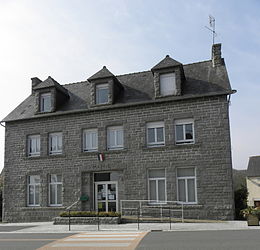 Town hall | |
show Location of Canihuel | |
 Canihuel | |
| Coordinates: 48°20′20″N 3°06′15″W / 48.3389°N 3.1042°WCoordinates: 48°20′20″N 3°06′15″W / 48.3389°N 3.1042°W | |
| Country | France |
| Region | Brittany |
| Department | Côtes-d'Armor |
| Arrondissement | Guingamp |
| Canton | Rostrenen |
| Intercommunality | Kreiz-Breizh |
| Government | |
| • Mayor (2014–2020) | Jean-Louis Mobuchon |
| Area 1 | 32.14 km2 (12.41 sq mi) |
| Population (Jan. 2018)[1] | 351 |
| • Density | 11/km2 (28/sq mi) |
| Time zone | UTC+01:00 (CET) |
| • Summer (DST) | UTC+02:00 (CEST) |
| INSEE/Postal code | 22029 /22480 |
| Elevation | 149–296 m (489–971 ft) |
| 1 French Land Register data, which excludes lakes, ponds, glaciers > 1 km2 (0.386 sq mi or 247 acres) and river estuaries. | |


Canihuel (Breton: Kanuhel) is a commune in the Côtes-d'Armor department of Brittany in northwestern France.
Population[]
| Year | Pop. | ±% |
|---|---|---|
| 1861 | 1,612 | — |
| 1881 | 1,503 | −6.8% |
| 1901 | 1,509 | +0.4% |
| 1921 | 1,311 | −13.1% |
| 1946 | 947 | −27.8% |
| 1962 | 771 | −18.6% |
| 1968 | 653 | −15.3% |
| 1975 | 558 | −14.5% |
| 1982 | 461 | −17.4% |
| 1990 | 429 | −6.9% |
| 1999 | 420 | −2.1% |
| 2008 | 376 | −10.5% |
Inhabitants of Canihuel are called Canihuelois or Canihelois in French.
See also[]
References[]
- ^ "Populations légales 2018". INSEE. 28 December 2020.
External links[]
| Wikimedia Commons has media related to Canihuel. |
- Base Mérimée: Search for heritage in the commune, Ministère français de la Culture. (in French)
This Côtes-d'Armor geographical article is a stub. You can help Wikipedia by . |
Categories:
- Communes of Côtes-d'Armor
- Côtes-d'Armor geography stubs