Caurel, Côtes-d'Armor
Caurel
Kaorel | |
|---|---|
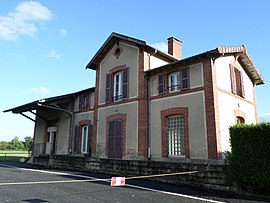 The old train station in Caurel | |
show Location of Caurel | |
 Caurel | |
| Coordinates: 48°13′01″N 3°02′14″W / 48.2169°N 3.0372°WCoordinates: 48°13′01″N 3°02′14″W / 48.2169°N 3.0372°W | |
| Country | France |
| Region | Brittany |
| Department | Côtes-d'Armor |
| Arrondissement | Saint-Brieuc |
| Canton | Mûr-de-Bretagne |
| Intercommunality | Loudéac Communauté - Bretagne Centre |
| Government | |
| • Mayor (2020–2026) | Jean-Louis Martigné |
| Area 1 | 11.65 km2 (4.50 sq mi) |
| Population (Jan. 2018)[1] | 358 |
| • Density | 31/km2 (80/sq mi) |
| Time zone | UTC+01:00 (CET) |
| • Summer (DST) | UTC+02:00 (CEST) |
| INSEE/Postal code | 22033 /22530 |
| Elevation | 120–308 m (394–1,010 ft) |
| 1 French Land Register data, which excludes lakes, ponds, glaciers > 1 km2 (0.386 sq mi or 247 acres) and river estuaries. | |


Caurel (French pronunciation: [koʁɛl]; Occitan: Kaorel) is a commune in the Côtes-d'Armor department of Brittany in northwestern France.
Population[]
| Year | Pop. | ±% |
|---|---|---|
| 1962 | 342 | — |
| 1968 | 434 | +26.9% |
| 1975 | 358 | −17.5% |
| 1982 | 376 | +5.0% |
| 1990 | 384 | +2.1% |
| 1999 | 387 | +0.8% |
| 2008 | 384 | −0.8% |
Inhabitants of Caurel are called Caurelois in French and Kaoreliz in Breton.
See also[]
References[]
- ^ "Populations légales 2018". INSEE. 28 December 2020.
External links[]
| Wikimedia Commons has media related to Caurel (Côtes-d'Armor). |
- Base Mérimée: Search for heritage in the commune, Ministère français de la Culture. (in French)
This Côtes-d'Armor geographical article is a stub. You can help Wikipedia by . |
Categories:
- Communes of Côtes-d'Armor
- Côtes-d'Armor geography stubs