Gouarec
Gouarec
Gwareg | |
|---|---|
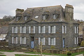 The town hall of Gouarec | |
 Coat of arms | |
show Location of Gouarec | |
 Gouarec | |
| Coordinates: 48°13′38″N 3°10′46″W / 48.2272°N 3.1794°WCoordinates: 48°13′38″N 3°10′46″W / 48.2272°N 3.1794°W | |
| Country | France |
| Region | Brittany |
| Department | Côtes-d'Armor |
| Arrondissement | Guingamp |
| Canton | Rostrenen |
| Intercommunality | Kreiz-Breizh |
| Government | |
| • Mayor (2014–2020) | Jean-Yves Le Guyader |
| Area 1 | 6.41 km2 (2.47 sq mi) |
| Population (Jan. 2018)[1] | 942 |
| • Density | 150/km2 (380/sq mi) |
| Time zone | UTC+01:00 (CET) |
| • Summer (DST) | UTC+02:00 (CEST) |
| INSEE/Postal code | 22064 /22570 |
| Elevation | 127–210 m (417–689 ft) |
| 1 French Land Register data, which excludes lakes, ponds, glaciers > 1 km2 (0.386 sq mi or 247 acres) and river estuaries. | |


Gouarec (Breton: Gwareg) is a commune in the Côtes-d'Armor department of Brittany in northwestern France.
Population[]
Inhabitants of Gouarec are called gouarécains in French.
See also[]
References[]
- ^ "Populations légales 2018". INSEE. 28 December 2020.
External links[]
| Wikimedia Commons has media related to Gouarec. |
- Base Mérimée: Search for heritage in the commune, Ministère français de la Culture. (in French)
- Biking along the Nantes-Brest canal
This Côtes-d'Armor geographical article is a stub. You can help Wikipedia by . |
Categories:
- Communes of Côtes-d'Armor
- Côtes-d'Armor geography stubs