Lamballe-Armor
Lamballe-Armor | |
|---|---|
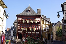 The Lamballe Museum | |
Location of Lamballe-Armor  | |
 Lamballe-Armor | |
| Coordinates: 48°28′10″N 2°31′00″W / 48.4694°N 2.5167°WCoordinates: 48°28′10″N 2°31′00″W / 48.4694°N 2.5167°W | |
| Country | France |
| Region | Brittany |
| Department | Côtes-d'Armor |
| Arrondissement | Saint-Brieuc |
| Canton | Lamballe and Pléneuf-Val-André |
| Intercommunality | Lamballe Terre et Mer |
| Government | |
| • Mayor (2020–2026) | Philippe Hercouet |
| Area 1 | 130.65 km2 (50.44 sq mi) |
| Population (Jan. 2018)[1] | 16,742 |
| • Density | 130/km2 (330/sq mi) |
| Time zone | UTC+01:00 (CET) |
| • Summer (DST) | UTC+02:00 (CEST) |
| INSEE/Postal code | 22093 /22400 |
| Elevation | 0–131 m (0–430 ft) |
| 1 French Land Register data, which excludes lakes, ponds, glaciers > 1 km2 (0.386 sq mi or 247 acres) and river estuaries. | |


Lamballe-Armor (French pronunciation: [lɑ̃bal aʁmɔʁ]) is a commune in the Côtes-d'Armor department in Brittany in northwestern France. It was established on 1 January 2019 by merger of the former communes of Lamballe (the seat), Morieux and Planguenoual.[2]
References[]
- ^ "Populations légales 2018". The National Institute of Statistics and Economic Studies. 28 December 2020.
- ^ Arrêté préfectoral 31 October 2018 (in French)
| Wikimedia Commons has media related to Lamballe-Armor. |
This Côtes-d'Armor geographical article is a stub. You can help Wikipedia by . |
Categories:
- Communes of Côtes-d'Armor
- Côtes-d'Armor geography stubs