Trémel
Trémel
Tremael | |
|---|---|
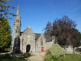 The church of Notre-Dame de la Merci, in Trémel | |
 Coat of arms | |
show Location of Trémel | |
 Trémel | |
| Coordinates: 48°36′14″N 3°36′37″W / 48.6039°N 3.6103°WCoordinates: 48°36′14″N 3°36′37″W / 48.6039°N 3.6103°W | |
| Country | France |
| Region | Brittany |
| Department | Côtes-d'Armor |
| Arrondissement | Lannion |
| Canton | Plestin-les-Grèves |
| Intercommunality | Lannion-Trégor Communauté |
| Government | |
| • Mayor (2020–2026) | Cécile Auriac |
| Area 1 | 11.93 km2 (4.61 sq mi) |
| Population (Jan. 2018)[1] | 409 |
| • Density | 34/km2 (89/sq mi) |
| Time zone | UTC+01:00 (CET) |
| • Summer (DST) | UTC+02:00 (CEST) |
| INSEE/Postal code | 22366 /22310 |
| Elevation | 25–155 m (82–509 ft) |
| 1 French Land Register data, which excludes lakes, ponds, glaciers > 1 km2 (0.386 sq mi or 247 acres) and river estuaries. | |


Trémel (French pronunciation: [tʁemɛl] (![]() listen); Breton: Tremael) is a commune in the Côtes-d'Armor department of the region of Brittany in northwestern France.
listen); Breton: Tremael) is a commune in the Côtes-d'Armor department of the region of Brittany in northwestern France.
Population[]
| Year | Pop. | ±% |
|---|---|---|
| 1962 | 481 | — |
| 1968 | 508 | +5.6% |
| 1975 | 465 | −8.5% |
| 1982 | 446 | −4.1% |
| 1990 | 403 | −9.6% |
| 1999 | 393 | −2.5% |
| 2008 | 403 | +2.5% |
Inhabitants of Trémel are called trémélois in French.
See also[]
References[]
- ^ "Populations légales 2018". INSEE. 28 December 2020.
External links[]
| Wikimedia Commons has media related to Trémel. |
- Base Mérimée: Search for heritage in the commune, Ministère français de la Culture. (in French)
This Côtes-d'Armor geographical article is a stub. You can help Wikipedia by . |
Categories:
- Communes of Côtes-d'Armor
- Côtes-d'Armor geography stubs