Châtelaudren-Plouagat
Châtelaudren-Plouagat | |
|---|---|
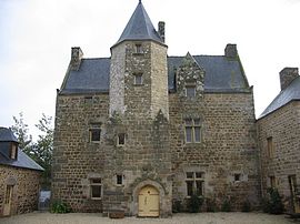 Manor house of Fournebello | |
Location of Châtelaudren-Plouagat  | |
 Châtelaudren-Plouagat | |
| Coordinates: 48°32′15″N 2°59′51″W / 48.5375°N 2.9975°WCoordinates: 48°32′15″N 2°59′51″W / 48.5375°N 2.9975°W | |
| Country | France |
| Region | Brittany |
| Department | Côtes-d'Armor |
| Arrondissement | Guingamp |
| Canton | Plélo |
| Intercommunality | Leff Armor |
| Area 1 | 32.44 km2 (12.53 sq mi) |
| Population (Jan. 2018)[1] | 3,888 |
| • Density | 120/km2 (310/sq mi) |
| Time zone | UTC+01:00 (CET) |
| • Summer (DST) | UTC+02:00 (CEST) |
| INSEE/Postal code | 22206 /22170 |
| Elevation | 68–262 m (223–860 ft) |
| 1 French Land Register data, which excludes lakes, ponds, glaciers > 1 km2 (0.386 sq mi or 247 acres) and river estuaries. | |

Châtelaudren-Plouagat is a commune in the Côtes-d'Armor department of Brittany in northwestern France. It was established on 1 January 2019 by merger of the former communes of Plouagat (the seat) and Châtelaudren.[2]
See also[]
References[]
- ^ "Populations légales 2018". The National Institute of Statistics and Economic Studies. 28 December 2020.
- ^ Arrêté préfectoral 28 September 2018 (in French)
| Wikimedia Commons has media related to Châtelaudren-Plouagat. |
This Côtes-d'Armor geographical article is a stub. You can help Wikipedia by . |
Categories:
- Communes of Côtes-d'Armor
- Côtes-d'Armor geography stubs
- Populated places established in 2019
- 2019 establishments in France